Day 47 – saddle to near Kern River – 23 miles


We hiked all day with the river on our minds but nature got in the way at the end. In the early evening we left the hills and entered the huge Kern plateau – a wide open canyon bordered by ridges on the east and west. We turned north and headed for the river. Before we’d gotten too far we heard thunder from a nearby front that we’d thought was far enough away to not bother us. A minute later we heard more thunder and felt a few drops of rain and then suddenly it was pouring. We were caught completely out in the open – 15 minutes earlier we would have been able to take shelter in the trees near a creek, 15 minutes later and we would have been in the pines. As it was all we could do was crouch down next to a juniper shrub as the rain changed to sleet and the thunder broke right over our heads. We were lucky that we at least had our umbrellas open when it started since we didn’t have time to dig out our rain gear.


Eventually the rain let up a little and we started hiking for the pine forest up the trail. Moving helped us keep warm and got us closer to a protected campsite. The sun was close to setting and we knew we needed to make camp soon before it started to get cold. In a matter of minutes we went from thinking about swimming in the river to worrying about hypothermia. Luckily our sleeping bag and clothes were dry in their plastic liners. It was very damp out and the tent dripped on us all night. At least we’ll reach town tomorrow and can dry everything out.

– Posted from the PCT

Location:Pct mile 696

Day 46 – Walker Pass to saddle near Spanish Needle Creek – 22 miles


What a difference a day makes! We were up at 5 and were rewarded by being first in line for pancakes – no small feat for us! They had both coffee and tea and I had a mug of each. Out here we’re not willing to take the time or fuel to heat water for them. I’ve missed hot drinks and it was wonderful to have them on this cool morning. After that and some Gatorade we were fully rehydrated and ready to pack up. We thanked the team of trail angels profusely and left a big donation – still inadequate to express how grateful we were for their efforts but at least they can buy lots of food for other hikers with it. We passed around word of my headlamp and left a note in the register but it looks like we’ll have to catch up with Doodles in Kennedy Meadows since she’s still behind us.


It was hard to leave but we were eager to get hiking. We’ve done a short stretch of this section (we’re somehow all the way to California section G, if you’re keeping track) two years ago with my older brother when we came to LA for a friend’s wedding. We only did about 17 miles out and back, to the second water source, but it took us 3 days. I was curious to see how it would stack up against my memory. I certainly remembered the climb out of Walker Pass – steep but well-graded up nice switchbacks with great open views. Once we got to the top of the ridge I found a small Swiss Army knife which I hope to return to its owner in Kennedy Meadows. Maybe it will generate some good karma and help get my headlight back.


We hiked through more piñon pines and scrub as we came around Mt. Jenkins on our way to Mt. Owens. Sometimes we had to pick our way over rockslides that had been flattened to make trail – a bit of a delicate operation since they shifted around a lot under our feet and grabbed at the tips of our hiking poles. Eventually we passed through a burned area and north to reach the saddle between the two peaks. This marked the start of a switchbacking descent. Some of the rockslides here had been filled over with good dirt to make walking easier and it was nice to see this kind of trail maintenance since we’d been here last. After skirting the low slopes of another mountain we reached the spur trail for Joshua Tree Spring 12 miles from our starting point. This was where we camped for two nights in 2011 and we were looking forward to the good water and the shade. It had gotten pretty hot during our hike and the sun was relentless. The spring was about a quarter mile off trail and downhill in a gully and was an oasis from the heat above.


A few other hikers showed up and we all wiped ourselves down at the trough and soaked our feet for a while. This is considered bad etiquette by some since we were putting our feet in the water but I’ve yet to meet a hiker who would take water from a scummy trough instead of the running pipe feeding it. We had brought sodas and Gatorade from the campground and we floated them in the water to cool them off for lunch. Afterwards we did some laundry and collected enough water to get us 6 miles to the next source. This water is designated as unsafe for use due to its uranium content – which sounds bad, but the truth is that it’s only very slightly above the government limit for radiation in drinking water. Grabbing a liter and soaking ourselves isn’t going to hurt us.


We spent a lot of time relaxing, unwilling to head up the steep trail back into the sun, but it had to be done sometime. We wetted down our clothes and heads liberally and it helped a ton. We were nearly dry by the time we reached the spur junction again. After a mile or so of descent we started climbing in earnest to a high saddle, then dropping down the other side and climbing again to the first crossing of Spanish Needle Creek. In 2011 (a wet year) it had been flowing but this time it was dry. We pushed on to the second crossing, which involved more uphill, and found good trickling rivulets upstream from the trail.


By this time we were thinking about where to camp for the night. Since we’re in the steep mountains now flat spots are not as common as we’re used to and after looking at the contour map we decided our best shot was a saddle three miles ahead and way above us. We made it right as the last bit of usable light was fading and found a little nook among the scrub to bed down for the night. It had been a day with lots of climbing but we handled it with relative ease – a good example of what we can do when fully hydrated and nourished. We are excited to be further north than ever before on the trail and heading for the Sierra. It’s really starting to transition from desert to mountains. We likely won’t make Kennedy Meadows tomorrow but we ought to be able to reach the Kern River and do some swimming – something we could only dream of during the last 700 miles! If our elevation calculator is to be believed we did more than a mile of uphill and nearly a mile of downhill today. I’m suspicious since we’re not dead on our feet but all the work we did is something to be proud of for sure.

– Posted from the PCT

Location:Pct mile 673

Day 45 – Bird Spring Pass to Walker Pass campground – 21 miles


Today went from rough to great in a matter of moments. We woke up tired from had hiking late the previous night. Since we picked a spot in the dark we didn’t realize that we had set up camp right next to an anthill and they were crawling dangerously close to our heads and bags. This did have the benefit of waking us up quickly, but it was the first mishap in a tough morning. We started with a long climb and were still worn out from the previous day. We had expected it to be cooler today but it was still hot. As we reached the ridge at the top of the climb we moved from desert scrub to scraggly piñon pine. They didn’t offer very much shade but it was nice to walk on the duff instead of in sand.


We made good time over a few miles as the trail dropped gradually to Yellowjacket spring, which we bypassed thanks to the previous water cache. It saved us a lot of time – the spring is actually a seep and it would have taken a while to produce enough to get us to the next source. It was downhill nearly a mile away, which means that it’s a mile uphill when we’re laden with a gallon each. This stretch of trail would be much harder without the lady who maintains this cache and the one from yesterday…and it’s already pretty tough.

After the turnoff for the spring we started gradually gaining elevation back and we were dragging in the heat. We were moving too slowly to make the miles we wanted. Finally we decided to stop for a quick lunch break and that’s when our luck started changing. We happened to have cell service so Keith was able to call the store at Kennedy Meadows and confirm their hours. They’re open later than we expected since there are so many hikers there this year. We might still have a chance to make it there on Tuesday before it closes. Right after getting this bit of info, we happened to mention my missing headlamp to two passing hikers…who knew about a hiker behind us that had found a lamp similar to it. It might not be mine but it sounds promising.

After these encouragements and some good food we set off with renewed energy. The rest of the trail to Walker Pass was nearly flat with a big descent at the end. Almost immediately we came out onto semi-open ridgetops with great views of the peaks to come. It was still hot but late enough in the afternoon that it was starting to cool down a little. At last we had some breeze. We followed an old ATV road for a while before peeling back onto trail as we started the drop to the campground. The views got better as we went, with Mt. Owens looming to the north across highway 178. We’ll skirt it tomorrow but thankfully don’t have to go to the top.


We had read a few rumors about trail magic at the campground but didn’t want to get our hopes up. Cool water and a chance to wash our faces would be a reward in itself, even if the water came from a livestock cistern down the road from the dry camp. Still, we were overjoyed to see the note at the junction beckoning us down to the blue tarp and the crowd of hikers there. We got the cold sodas I’d been thinking about from sunup to sundown yesterday. After that, gatorade, burgers, and a piece of cake we felt like different hikers from the ones who had started this morning so badly. I got to meet Yogi, something of a trail celebrity. She writes one of the most-often read books on hiking the trail and a guide to the different towns, which is part of how we decide on where to stay and eat.


We planned to make a few more miles until the mention of pancakes early in the morning convinced us to camp here tonight. We still did our laundry at the cow tanks, but at least we didn’t have to drink the stuff. We saw our third rattlesnake in two days when one of the guys at the camp called us over to see a big Mojave Green under a bush. He got a bunch of hikers to voluntarily leave their food and drink – no small feat! The Greens are more dangerous than the standard Diamondbacks – stronger venom. He wasn’t too happy to be surrounded by people but it was cool to see one without being surprised by it. What a day! It’s hard to comprehend just how much better it ended than how it started.


– Posted from the PCT

Location:Pct mile 652

Day 44 – Concrete dam to Bird Spring Pass – 25 miles


Today was mostly a long, hot walk through the desert. We started off in a nice pine forest for a change as we hiked the three miles to Landers Camp and the spring there. The spring had the best flow we’ve seen in a while and we did our laundry and washed up a little after filtering our water.


Back on the trail we continued on for another mile or so in the forest before entering another burn area. Before long we were dropping down ridges to the desert floor and the crossing of Kelso Valley Road. On the way down I heard a rattlesnake buzzing, but he was far enough off trail to not be a threat. At the road crossing was a huge water cache and we actually took a few liters as insurance against the desert. This allowed us to hike right through to the next cache instead of having to go off trail and lose a lot of elevation to refill.


This is the last real desert section we’ll cross and it was one of the toughest. It was over 100 degrees and there was a lot of climbing on sandy trail, where half the effort of every step is lost. We got a brief respite when we rounded a tall mountain on some rocky trail in the pines. It reminded me of the hike out of Walker Pass, which we’ll do tomorrow or the day after. We had long views out over the Mojave. I met another rattlesnake but he was so small that it was hard to find him at first. We finished up the day in the dark, determined to make our miles and reach the next water cache.


I spent most of the day thinking about cold drinks. When we started this hike I thought I would be dreaming about town food – pizza and burgers and such. But I’ve mainly been craving cold beverages: a tall cup of soda, brimming with ice; or lemonade with condensation beading on the glass; or like I got in Tehachapi at the Greek restaurant, cold mint tea. That last one’s been a fixture over the last few days especially. Only a few more days to Kennedy Meadows. We should reach it on my birthday and if we get there early enough we can hit the store before it closes and celebrate with a cold drink. If that’s not an incentive, I don’t know what is.


– Posted from the PCT

Location:Pct mile 631

Day 43 – Golden Oak Spring to concrete dam – 23 miles


We traded the wind for the heat today and I’m not sure which was better. After dragging ourselves out of bed and packing up, we ate breakfast down at the spring. There were many more people camped there than last night, some of whom we recognized from the last few days before town. As we ate some songbirds picked through the mud next to us – looking for bugs or pockets of water maybe. Whatever it was, they didn’t seem too concerned about us. We finished eating and hit the trail quickly to beat some of the heat.


Even though our elevation profile looked easier than yesterday, the day seemed to be nothing but uphills. We passed by more windmills and through desert scrub that started to give way to juniper. Mid-morning, just as it was really starting to warm up, we entered a burn area. It must have happened fairly recently because it was pretty barren between the charred tree skeletons, but at the base of some seemingly dead trees some new oak and manzanita shoots were starting to appear. I’d be curious to know how it looks a year from now.


After 13 miles and an especially tough climb we stopped for lunch at Hamp Williams Pass, a nondescript meadow. We couldn’t keep our eyes open and our food got a little extra time to steep while we got power naps. It was hard to get back on the trail – all we wanted to do was to go back to sleep – but we had to make the miles. 6 miles and a steep climb later we reached Robin Bird spring, the next water source. We had been conserving because of the heat so the first thing we did was filter a quart for each of us and flavor it up. It was wonderful to guzzle a cold drink after sipping on bathtub-warm water all day.


After leaving the spring we hiked until dark, trying to get all the miles we could. We had been shooting for 25 but as usual we moved slowly in the heat. Luckily there were many campsites scattered throughout the pine forest we had moved into and we found a place just off the trail but well-screened by trees. Tomorrow is supposed to be even hotter – 100 degrees back in Mojave – so it will be another tough one for us. The good news is that Sunday will be cooler so we should get some relief eventually.

– Posted from the PCT

Location:Pct mile 606

Day 42 – Mojave to Golden Oak Spring – 17 miles


The original plan this morning was to take the early bus again towards Tehachapi but to get off short at the PCT trailhead. When the alarm went off at 6:30 we knew it wasn’t going to happen since we were so exhausted. We slept in for a few blissful hours, then ate breakfast and finished packing up. Luckily, a local trail angel was happy to give us and another hiker a ride to the trail at noon. Ted is a member of the Mojave chamber of commerce and is trying to drum up the same kind of extensive trail angel support in that town as they have in Tehachapi. Hikers are an economic bump, even if the main season only lasts a month or so.

After getting dropped off we hoisted our full packs and set off east as the trail followed the highway. There was lots of garbage strewn around, as seems to happen any time the trail comes in close contact with civilization. After a few miles it turned north around a ridge and began climbing. The wind got worse as we got higher but it was much better than it had been over the last few days and we had intermittent protection as we switchbacked up. Finally we stood on top of the bluff and headed into pockets of juniper scrub. Behind us we could see the towns, the plane graveyard, and (way out in the distance) Edwards Air Force base. It was pleasant walking as we headed further into the mountains.

We encountered a few more lines of windmills but nothing like the density from yesterday. As we hiked we passed Mountain Goat and Stumbles, whom we haven’t met before. Mountain Goat actually works on wind turbines so this must have been an interesting section for him. Closer to our destination for the night, we passed two ladies who had just gotten done with school and were starting the trail on this section. Along with the couple we caught a ride with yesterday, we now know of four people starting at Mojave. I didn’t know it was so popular but I’d think it would be a tough section to start with – little water, high temperatures, and lots of hills. Plus, in only a week we hit the really high altitudes and tough climbs.

We finished the day at the spring, loading up for a 20-mile dry stretch. We are camped mostly out of the wind and looking forward to making progress tomorrow. I made the unhappy discovery that my brand new headlamp is missing. I put it in the same secure place every day so I’m not sure where I lost it – possibly at the hotel, which would at least give us the chance to maybe get it back. It’s a bad thing to lose on this section because we might need to do some night hiking to beat the heat.

– Posted from the PCT

Location:Pct mile 583

Day 41 – Mojave – 8 miles


Today was an early start for a town day. We caught the bus into Tehachapi to get breakfast and run some errands. Lunch was some excellent and very satisfying Greek food, and then we headed across the street to see a movie.

After the movie it was time to do a little work on our day off. We caught a ride back to the trailhead from yesterday and set out to hike an 8-mile section with minimal gear. Hikers call this slack-packing and this is the first time we’ve tried it. Keith graciously carried his pack, some water and our jackets. I walked without anything on my back for the first time in a long time and it felt wonderful. The wind was still bad but much better than yesterday. We had incredible views into the Mojave desert and could see hundreds of windmills of all different models and heights. It was hypnotic. The wind was still strong but not as bad as the previous days.

Before long we reached a ridge and could see the highway and train tracks down below. As usual, we had a few miles of frustratingly gentle switchbacks before we reached the ground. Sometimes they even went up a little, which to me defeats the purpose of building them for descent. Once back on the ground we were more protected from the wind and had a short roadwalk to the highway overpasses. We were briefly delayed by a long passing train, one of many that pass through Mojave and blare their horns all night.

We were going to catch the bus back to town since this is known to be a tough hitch, but while we were waiting a couple came up the off ramp and offered us a ride. Heather and Damien are starting the PCT here but got to Tehachapi too late to return their rental car, so they decided to drive out and see the trailhead. Their misfortune was our gain and we got back to the hotel nearly an hour earlier than we would have by bus. We had enough food to stay in and avoid the wind while we finished up the rest of our chores in preparation for leaving tomorrow. This will be a tough section but it will be exciting to finally reach the mountains!

– Posted from the PCT

Location:Pct mile 566

Day 40 – Tehachapi mountains to Mojave – 7 miles


We didn’t get the best sleep last night – the wind was so loud that it kept waking us up. The cold always makes it hard to get up but eventually we roused ourselves and set off back into the wind. It wasn’t as strong as it had been yesterday on the ridge but it was close. As we came down out of the mountains and away from the protecting ridges it got harder and harder to move forward around the bluffs. We started passing close to some of the many windmills in the Mojave/Tehachapi area. The clouds were still very turbulent and off to the north we could see them dropping a rainy mist. We were drizzled on as we dropped to the canyon floor and headed up Oak Creek towards the road.


Our timing was right on – just as we reached the intersection to hitch into Mojave a hiker ahead of us snagged a ride. It turned out that the guy who picked us up is one of the people who maintains the nice water cache we passed yesterday. He only had time to take us into Tehachapi, but we didn’t have to wait long to catch a cheap bus to Mojave. On the way into town we passed the huge airplane graveyard out in the desert. It seems strange to store planes out in this environment. Isn’t all the dust and wind bad for them? The winds were still unusually strong down here and walking up and down the Main Street in town to do our chores was a real challenge. We ate a lot of grit. We’re now holed up in our room, nice and clean, and relieved to be out of the wind as it rattles our window. Feeling pretty cozy…


– Posted from the PCT

Location:Pct mile 558

Day 39 – Mojave floor to Tehachapi mountains – 22 miles


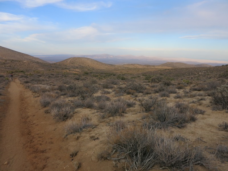
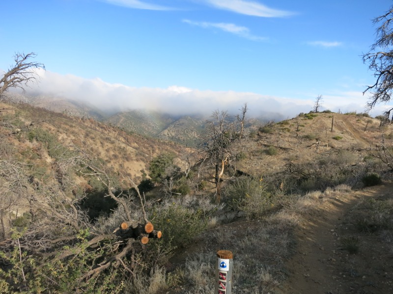
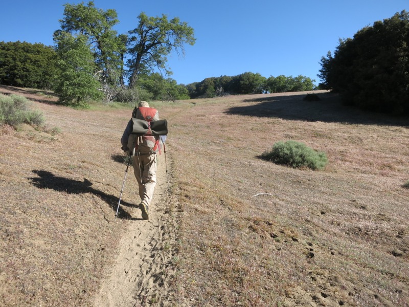
Wind was the name of the game today. We were a little worried about the temperature as we started hiking, but the breeze soon picked up and helped cool us off. In a few miles, and later that afternoon, we would be cursing it as we struggled to move forward.


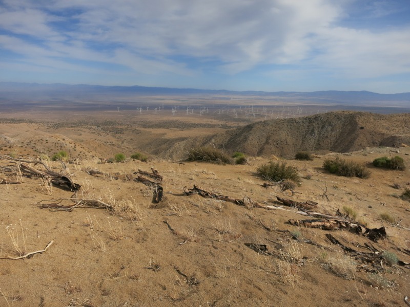
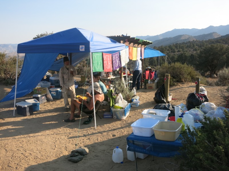
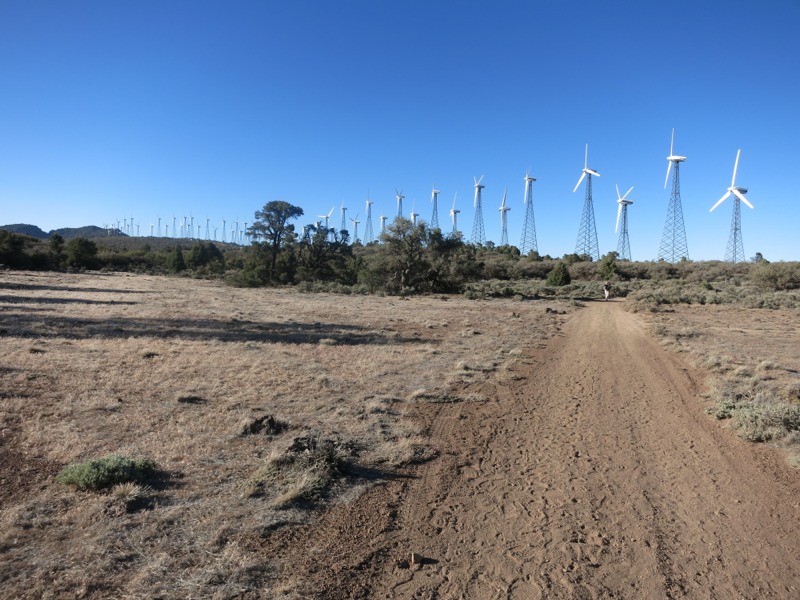
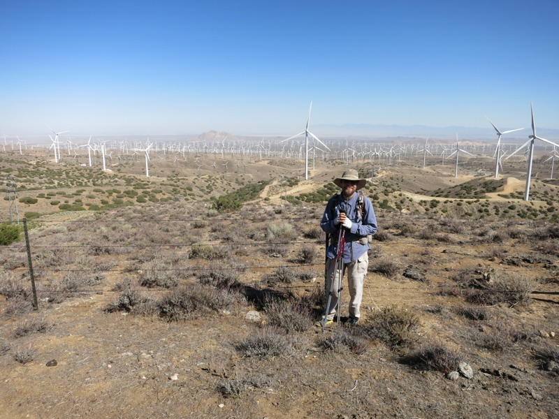
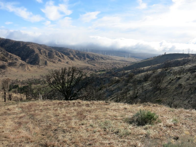
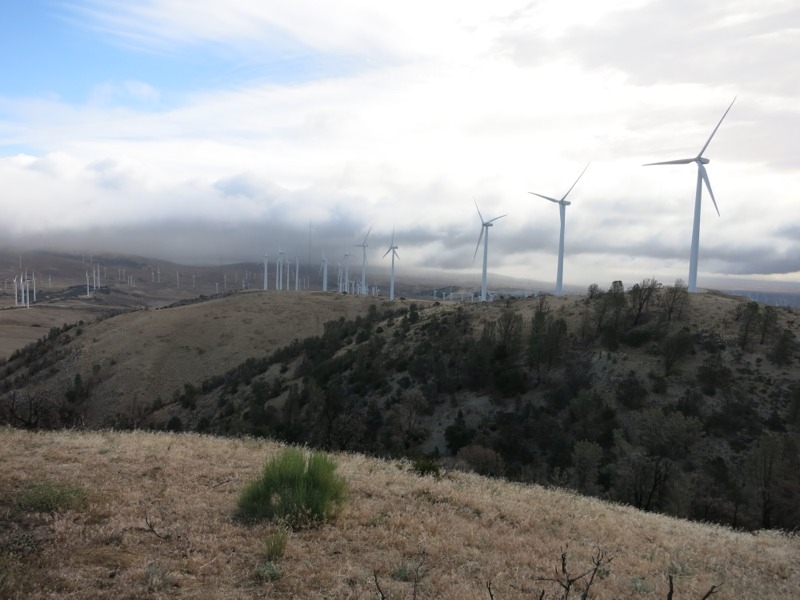
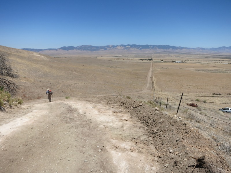
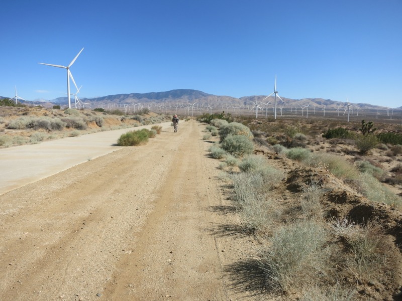
It was an easy hike to the Cottonwood Creek bridge on flat dirt roads. We passed a cache for hikers stocked with cold bottles of water – a welcome treat after drinking from our lukewarm bladders. After 5 miles we reached the bridge over the nonexistent creek. There were a bunch of other hikers hanging out near the water cache there. We took a short break and then headed north again, towards the hills and the massive wind farm before them. Before long we were out in the open enough to catch the wind that powered the turbines. It was nearly 7 miles of constant struggling, trying not to get blown over. Sometimes all we could do was brace and wait for the gust to let up a little. We cursed the Tejon Ranch the whole way. At the end we had a brutally steep climb up into the lower mountains. We stopped partway up to take a rest and were surprised to find out we were less than a mile from the next water. It felt like we had been going much slower than normal since every step had been so tough.


A little more climbing brought us to Tylerhorse Creek, where about 20 hikers were resting in the shade. We’re not used to seeing so many in one place all the time but that’s what we get for dropping back in the herd. We made lunch, replenished our water, and did a little laundry before lounging around. I tried to take a nap but only got a few minutes in before the group woke up. Frustrated and tired from this morning’s fight across the wind farm, we left soon after.

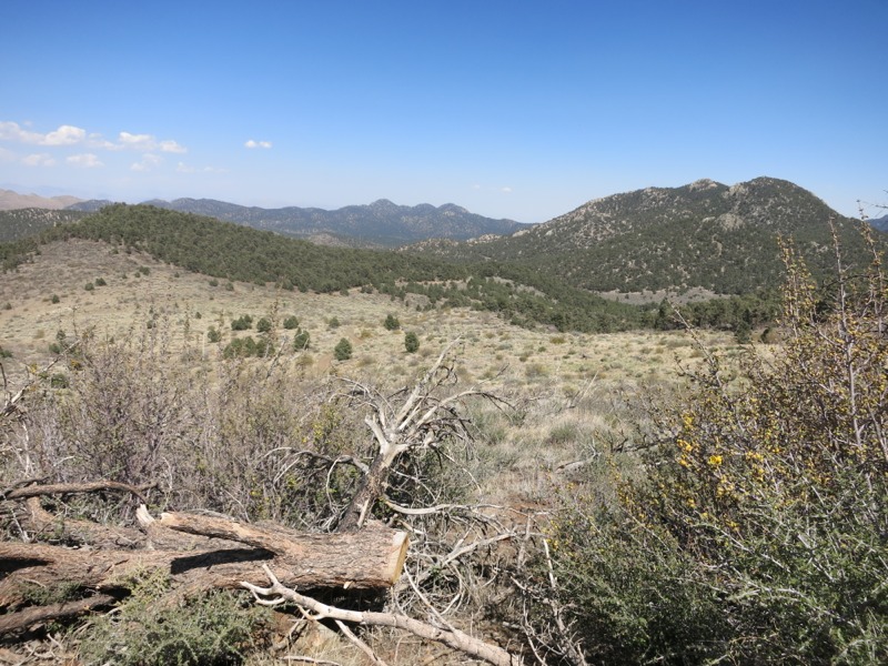
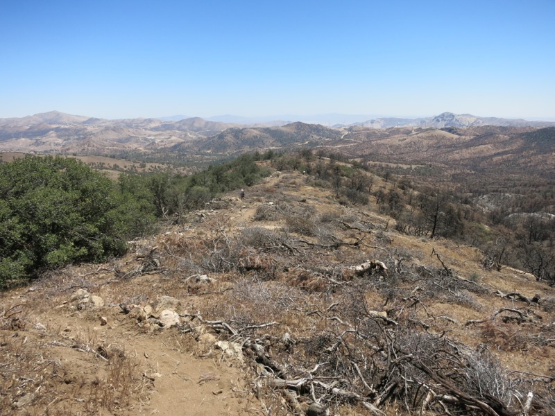
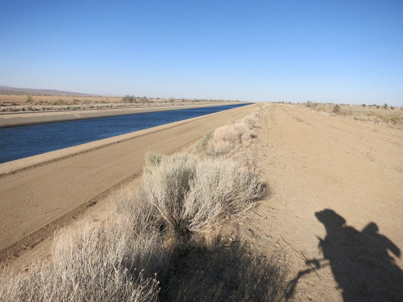
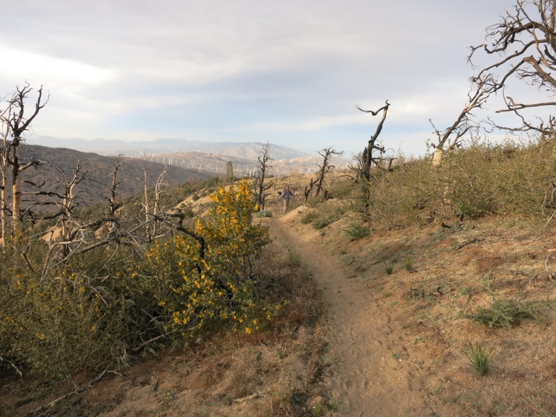
We skirted the side of the ridges to the east on sandy, mostly level trail for a time. The entire area was criss-crossed by dirt bike paths that cut directly up and down the slopes. Eventually we reached our second big climb of the day out of Gamble Spring Canyon. Of course, before we could hike up out of the canyon we had to hike down into it, so we lost 400 feet of elevation in full view of the switchbacks we would climb in a few minutes.

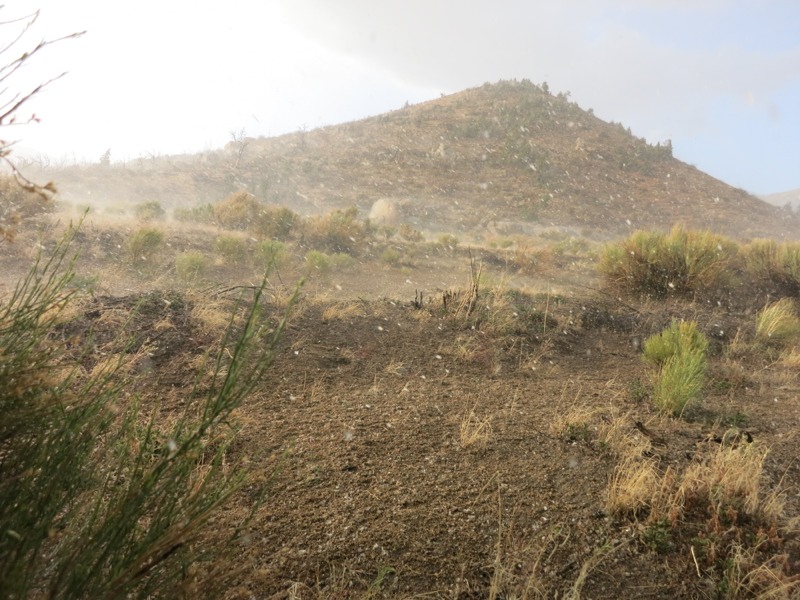
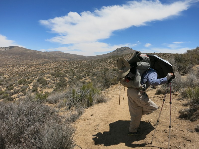
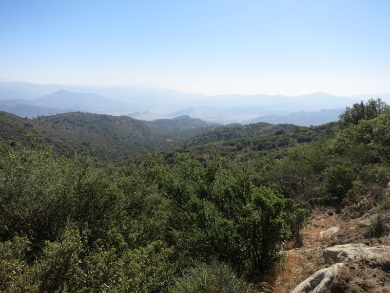
The climb wasn’t really too terrible until we got to the higher elevations above the surrounding ridges. Then the wind picked up again – strongly, and then so fiercely that we were a little worried for our safety. We were traversing sandy, eroding slopes along steep cliffs. At one point I was caught off guard by a gust and fell, nearly rolling off trail. If not for my hiking poles I couldn’t have gotten back up. It was bad enough going uphill but trying to fight what must have been 60-mph gusts was impossibly frustrating. Going with the wind wasn’t much easier since it literally shoved us along the trail and we had to make our legs work fast enough to keep up. If it caught us at an angle, it would twist our backpacks around and nearly tear them off our shoulders. It was brutal and there was no place to rest out of the gale until we got off the mountaintop. As bad as we had it, it might have been worse on the desert floor we left that morning. As we reached the ridge we could see enormous plumes of sand blowing across the Mojave basin. They were dark enough to blot out our view of the San Gabriel mountains across the floor.


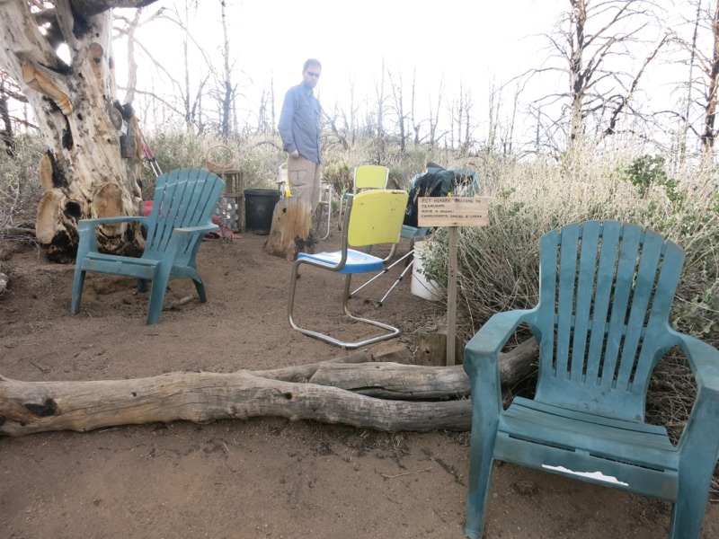
At last we reached a nice little cache that was slightly protected by the ridge. In addition to the water, it was stocked with delicious little green apples. There were only a few left and we felt lucky to come across them before they were gone. We took a rest in the provided chairs for a few minutes but got cold quickly once we stopped moving. We wanted to make it to 4 miles from the road into town but after struggling with the wind all day I was completely exhausted and needed to stop. It was hard to admit, though, and frustrating since we would easily have reached our goal of 25 miles without interference from the weather.


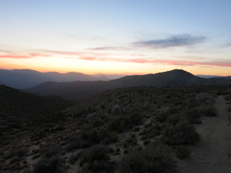
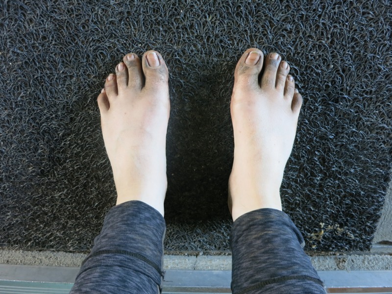
The trail stuck close to the ridgetop and looked pretty exposed for the next few miles, but Keith found a little flat spot downslope from the trail. It was surprisingly protected from the wind even though we couldn’t escape the noise of it all around us. For a while all I could do was lay in my bag and appreciate not having to use my muscles. After a while food started to seem appetizing again and we dug into our snacks, too tired and cold to cook a meal. The clouds above our heads were turbulent and ragged from the same weather front that was causing our wind problems. Later we would hear that there were high wind warnings for the entire surrounding area: Tehachapi, Mojave, and the desert we had just crossed. At least it hadn’t been hot. We are really looking forward to town – to being out of the wind, to new shoes, and to washing our shockingly filthy clothes.

– Posted from the PCT

Location:Pct mile 552

Day 38 – Liebre Mtn to Mojave floor – 24 miles


The night was so windy that we slept through our alarm, unable to hear it. We’re so close to the Mojave that it wasn’t a very cold breeze so it wasn’t as much of an excuse to stay in bed. It would be windy for most of the day – which, I guess, is a good reason to put wind farms in the desert.


We started the day with a long descent off of the mountain ridge to Pine Canyon Road. We hiked through more open territory than we’re used to seeing, with actual oak trees, meadows and views down off the ridge. Before long we passed a horse camp 4 miles up the trail, which had been our intended camp last night since it had a picnic table. I think we got a nicer spot by stopping short when we did. More switchbacks brought us at last to the trailhead and the nearly-empty cache there. It’s a good thing we haven’t been relying on them so far. We stopped and took a snack break before pushing on to climb the last few ridges between us and the desert. This was not very hiker-friendly territory and we saw lots of signs from the local hunting club warning us to stay on trail. As though we had any reason to stray, with Hikertown, shade and water only a few miles away. The breeze kept the temperatures very comfortable as we did out last uphills for the next 15 miles or so.


With 13 miles covered so far, we crossed Hwy 138 and entered Hikertown. This place totally reinforces the stereotype that eccentric people live way out in the boonies. It’s part old west town, part hostel. Hikers stay in the different “buildings” around town – city hall, the bunkhouse, the general store, etc. If someone has sent themselves a resupply box they can get it at the post office, of course. Add a bunch of chickens and dogs running around, and 30 or so hikers, and you get a real shock to the system. We were just glad to get off our feet. Someone was shuttling hikers to the convenience store up the highway so we were able to get sodas and snacks. The kitchen was cooking burgers and fries, which we topped off with some ice cream. I then topped that off with a short nap. All too soon the afternoon was waning, so we filled our water, collected our laundry and set off across the desert floor.


This is the flattest section we’ll hike on the trail. The reason we cross the desert instead of taking the Tehachapi mountains to the west is all due to one landholder – Tejon Ranch. For years the PCTA and the forest service negotiated with them to get right-of-way for the trail, but they wouldn’t budge. So instead of hiking in the hills under pines and past plentiful water sources, we hike in the desert under the sun with no natural water for miles and miles. A few years back it looked like they had finally reached an agreement to reroute the trail. This was a concession the ranch made in order to get approval on a housing/commercial development, though, and with the real estate market still dismal the whole thing is in flux. One way or the other it will be a long time before any PCT hiker sets foot in those mountains. Instead we follow the LA aqueduct for 10 miles or so. This is a whole other dispute, since it takes massive amounts of water from the valley east of the Sierras and routes it across the state for the LA valley’s use. Regardless of the morals involved, there was something hypnotizing about so much open water in one place after miles of desert. We haven’t seen anything like it since Silverwood reservoir before Wrightwood, 200 miles ago. We won’t see it again until the Kern River in another 200 miles.


Unfortunately, after a mile or so the aqueduct was routed underground and we were left to follow a big pipe, and eventually a concrete slab along a dirt road. It wasn’t vey interesting trail but at least it was flat. The sunset behind the off-limits mountains was beautiful. As we walked Inge dusk and then full night we could see the lights of a big city to the east – possibly Palmdale. We also saw the blinking red lights of the same wind farm again. We were expecting to hike by the light of the nearly-full moon, but it didn’t rise until we made camp. We have about 5 more miles of flat road walk tomorrow before we start up into the hills. After that is the town of Mojave, and we’ll be in the Sierras a week or so after that. They’re finally close enough for me to start getting excited about them!


– Posted from the PCT

Location:Pct mile 529