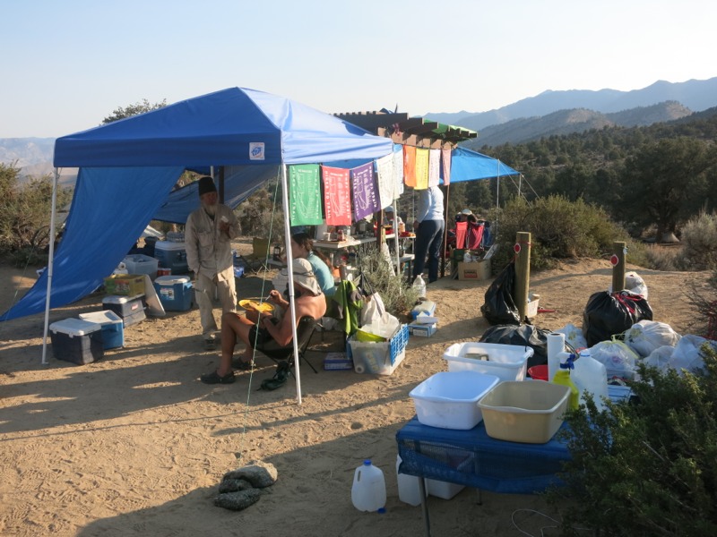
What a difference a day makes! We were up at 5 and were rewarded by being first in line for pancakes – no small feat for us! They had both coffee and tea and I had a mug of each. Out here we’re not willing to take the time or fuel to heat water for them. I’ve missed hot drinks and it was wonderful to have them on this cool morning. After that and some Gatorade we were fully rehydrated and ready to pack up. We thanked the team of trail angels profusely and left a big donation – still inadequate to express how grateful we were for their efforts but at least they can buy lots of food for other hikers with it. We passed around word of my headlamp and left a note in the register but it looks like we’ll have to catch up with Doodles in Kennedy Meadows since she’s still behind us.
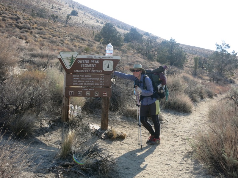
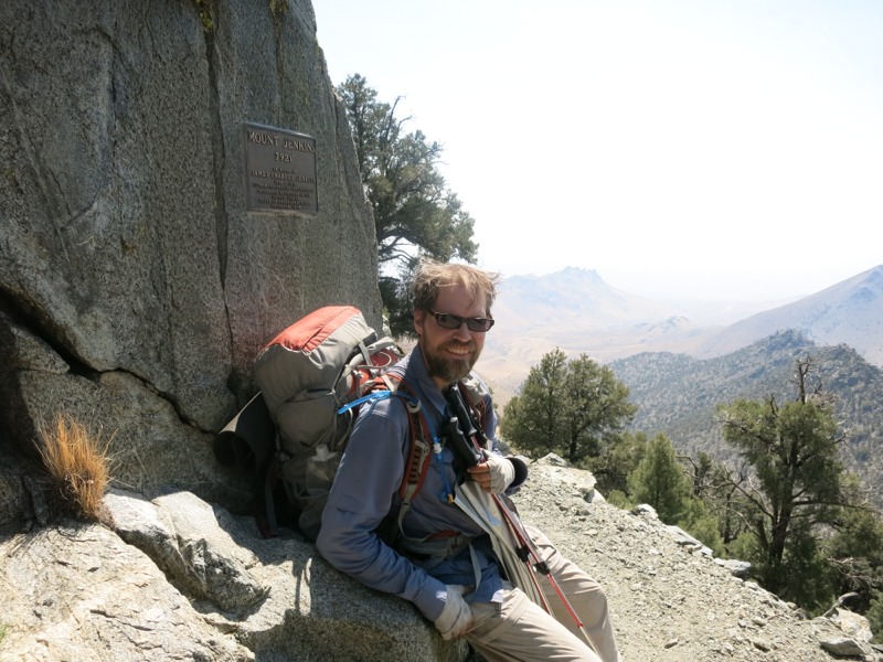
It was hard to leave but we were eager to get hiking. We’ve done a short stretch of this section (we’re somehow all the way to California section G, if you’re keeping track) two years ago with my older brother when we came to LA for a friend’s wedding. We only did about 17 miles out and back, to the second water source, but it took us 3 days. I was curious to see how it would stack up against my memory. I certainly remembered the climb out of Walker Pass – steep but well-graded up nice switchbacks with great open views. Once we got to the top of the ridge I found a small Swiss Army knife which I hope to return to its owner in Kennedy Meadows. Maybe it will generate some good karma and help get my headlight back.
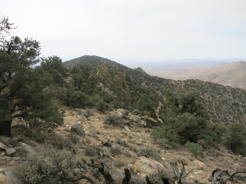
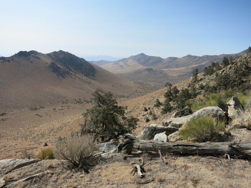
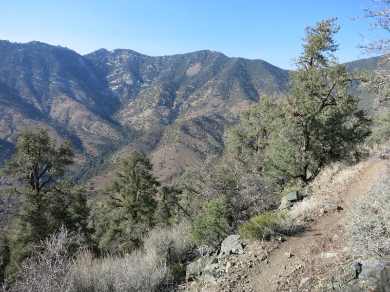
We hiked through more piñon pines and scrub as we came around Mt. Jenkins on our way to Mt. Owens. Sometimes we had to pick our way over rockslides that had been flattened to make trail – a bit of a delicate operation since they shifted around a lot under our feet and grabbed at the tips of our hiking poles. Eventually we passed through a burned area and north to reach the saddle between the two peaks. This marked the start of a switchbacking descent. Some of the rockslides here had been filled over with good dirt to make walking easier and it was nice to see this kind of trail maintenance since we’d been here last. After skirting the low slopes of another mountain we reached the spur trail for Joshua Tree Spring 12 miles from our starting point. This was where we camped for two nights in 2011 and we were looking forward to the good water and the shade. It had gotten pretty hot during our hike and the sun was relentless. The spring was about a quarter mile off trail and downhill in a gully and was an oasis from the heat above.
A few other hikers showed up and we all wiped ourselves down at the trough and soaked our feet for a while. This is considered bad etiquette by some since we were putting our feet in the water but I’ve yet to meet a hiker who would take water from a scummy trough instead of the running pipe feeding it. We had brought sodas and Gatorade from the campground and we floated them in the water to cool them off for lunch. Afterwards we did some laundry and collected enough water to get us 6 miles to the next source. This water is designated as unsafe for use due to its uranium content – which sounds bad, but the truth is that it’s only very slightly above the government limit for radiation in drinking water. Grabbing a liter and soaking ourselves isn’t going to hurt us.
We spent a lot of time relaxing, unwilling to head up the steep trail back into the sun, but it had to be done sometime. We wetted down our clothes and heads liberally and it helped a ton. We were nearly dry by the time we reached the spur junction again. After a mile or so of descent we started climbing in earnest to a high saddle, then dropping down the other side and climbing again to the first crossing of Spanish Needle Creek. In 2011 (a wet year) it had been flowing but this time it was dry. We pushed on to the second crossing, which involved more uphill, and found good trickling rivulets upstream from the trail.
By this time we were thinking about where to camp for the night. Since we’re in the steep mountains now flat spots are not as common as we’re used to and after looking at the contour map we decided our best shot was a saddle three miles ahead and way above us. We made it right as the last bit of usable light was fading and found a little nook among the scrub to bed down for the night. It had been a day with lots of climbing but we handled it with relative ease – a good example of what we can do when fully hydrated and nourished. We are excited to be further north than ever before on the trail and heading for the Sierra. It’s really starting to transition from desert to mountains. We likely won’t make Kennedy Meadows tomorrow but we ought to be able to reach the Kern River and do some swimming – something we could only dream of during the last 700 miles! If our elevation calculator is to be believed we did more than a mile of uphill and nearly a mile of downhill today. I’m suspicious since we’re not dead on our feet but all the work we did is something to be proud of for sure.
– Posted from the PCT
Location:Pct mile 673