We let ourselves sleep in a little this morning since the post office didn’t open until 8:30 and we had to retrieve our resupply package. We sorted through our new food while we ate breakfast from the little deli in the store of the RV park. We already had a lot on hand from shopping in Chester, so we had to whittle our supply down a bit – neither of us wanted to carry much extra today, when we would be carrying so much water weight.
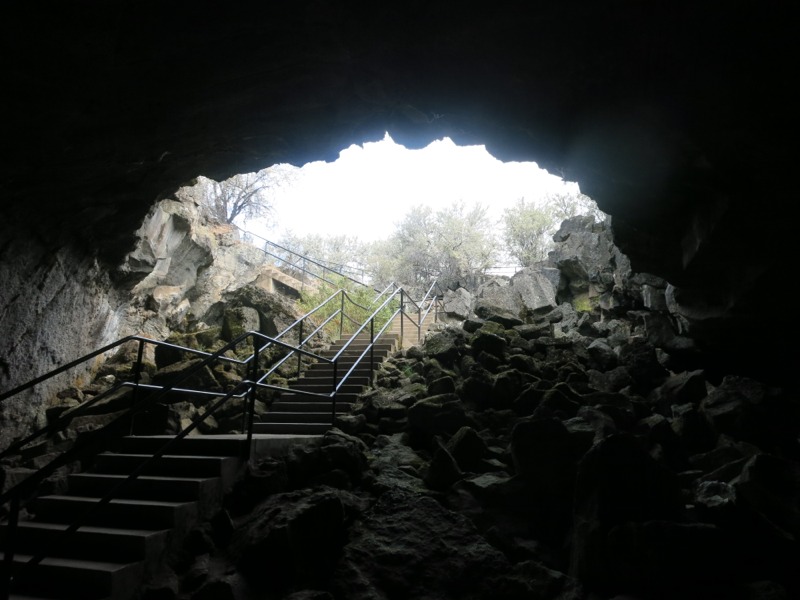
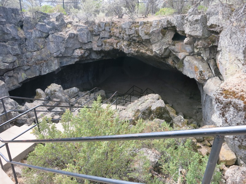
We set off down the trail to the Subway Cave and the last sure water for nearly 30 miles. The cave was a lava tube with stairs accessing it at either end and it was blissfully cool inside in contrast to the building heat of the day. It was dark, too, especially before our eyes had a chance to adjust. We had brought our headlamps but still had to move slowly over the rough floor. It was completely disorienting. At one spot I thought we had reached the end and turned around, when we were actually moving through the cave to the exit staircase. As we climbed out we could feel the temperature rising. We were loathe to go back out but the longer we waited the worse it would get.
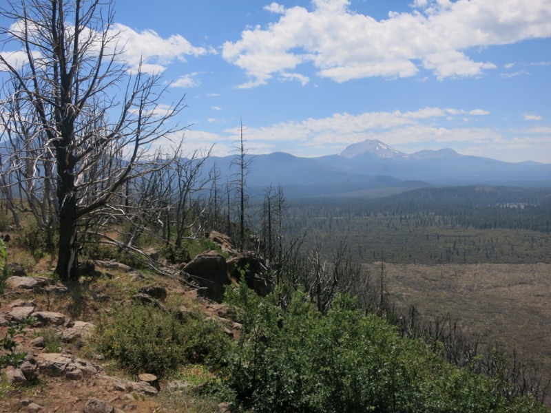
Outside we filled our water bottles and bags. This morning we’d learned good things about a water cache up on the rim, so we took a slight risk by only carrying 3 liters each. It would only get into the mid 80s, which helped. We’d heard that temperatures last week reached into the 100s – which was right around the time that we were roasting in Belden. Even as it was we were sweating freely when we left the spigots at the cave. We hiked through desert scrub and then sparse trees as we approached and climbed the rim. On top was more scrub and fewer trees. This area was burned in a fire a few years ago and was almost completely exposed.
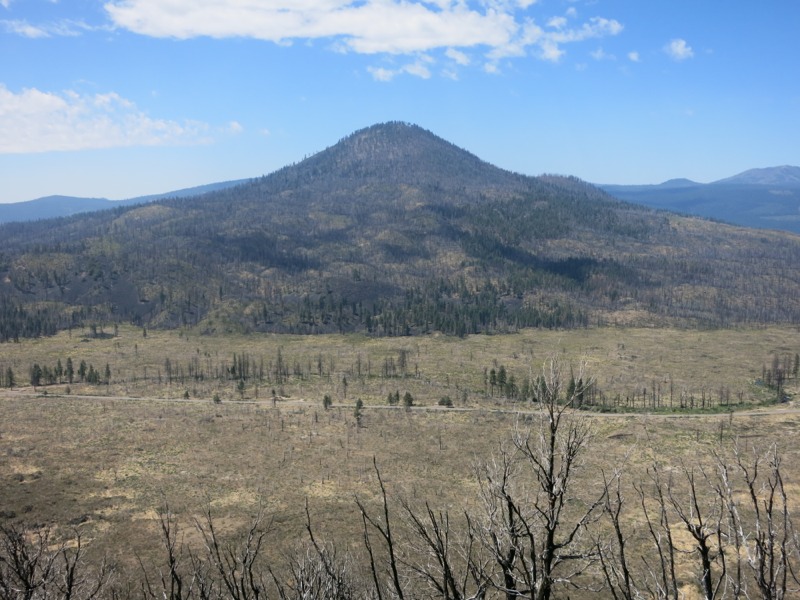
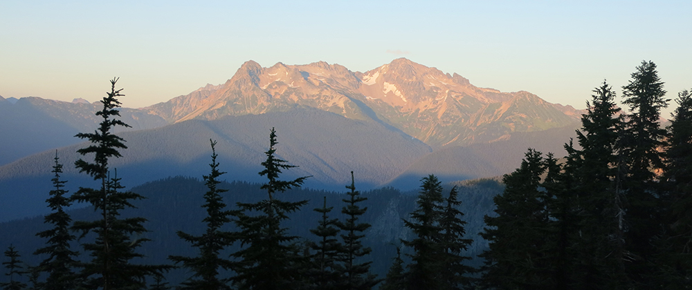
We hiked north, at times right along the rim’s edge, looking down at the highway below. The trail was full of fine gray volcanic dust that puffed up with every step. It was alternately clear and lined with sharp volcanic rocks, so we had to spend a lot of time watching our feet. We were so loaded down with water that a stumble could easily turn into a bad fall. The western horizon was dotted with mountains – Lassen to the south, Sugarloaf directly to our left, and a few smaller peaks to the north. We were supposed to be able to see Shasta from here but the haze from distant fires prevented us from catching a glimpse.
We swung east to skirt the deep canyon Lost Creek cut into the rim. We could hear water but there was no way to get down to it. After what seemed like miles we rounded a corner and headed northwest to return to the rim north of the intrusion. Soon after we stopped in a rare patch of shade to rest, drink, and snack. Our strategy was to break the rim walk into sections. Now we had three miles to go to the relay station (the site of a fire tower before the area burned), then another three to the cache, then as many as we could do before dark.
The relay station marked the end of our very slight elevation gain. The next few miles to the cache was a similarly slight downhill but rocky in parts and we had to move slowly over the rough patches. It didn’t slow us down too badly and we reached the cache in good time. We refilled our supply for tonight and tomorrow morning, then relaxed in the provided chairs and had another snack.
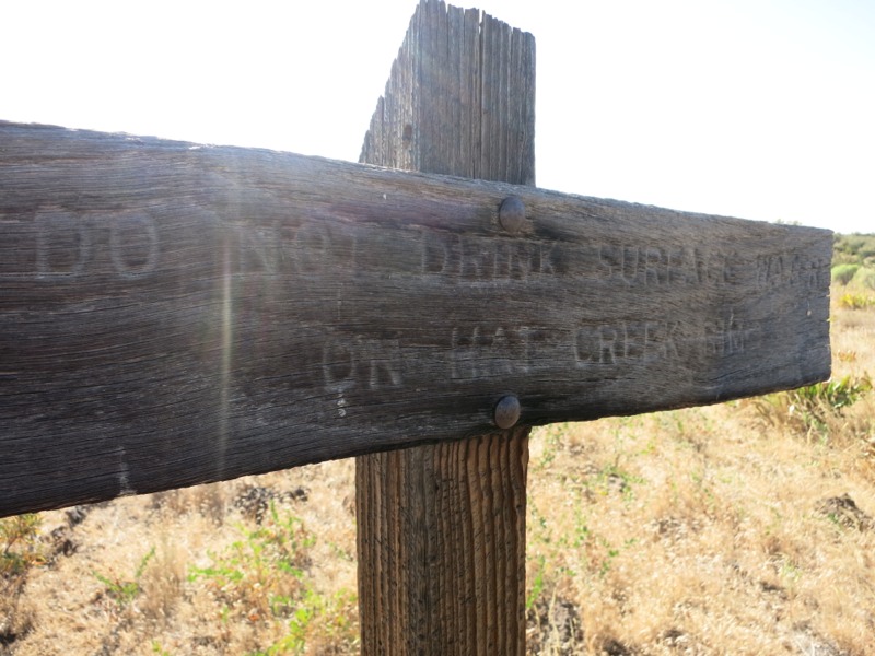
After leaving the cache we seemed to cross into cow country. Cow prints and cow pies were everywhere. At one point we passed the first surface water we’d seen all day – an incredibly mucky wallow. I pity the backpacker so low on water that he has to consider drinking that sludge. Apparently someone else pitied him too, because he or she had left a few jugs of clean well water on the other side of the trail.
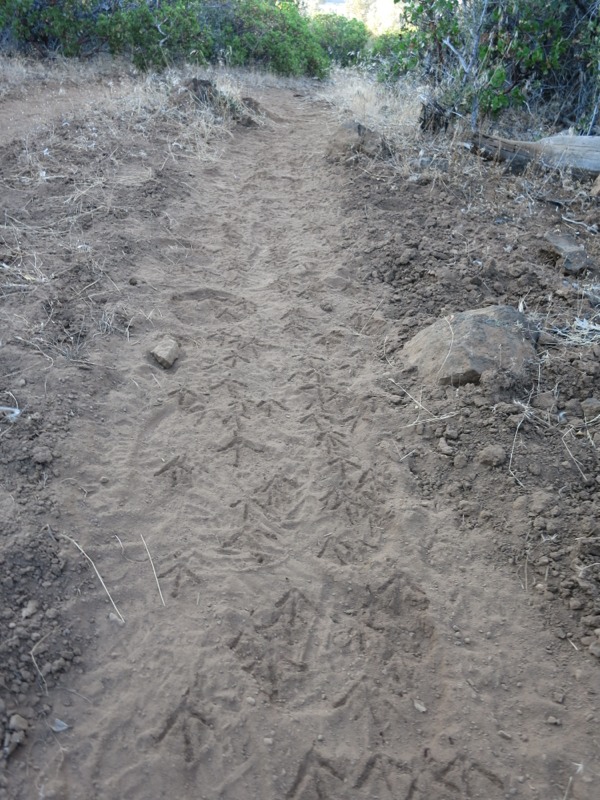
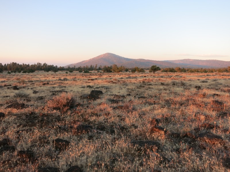
The trail had wandered away from the rim when we entered the pasture area but now it headed back. We passed a stretch that looked like a quail superhighway – their tracks were everywhere in the fine dust. Animals use the trail as a walkway too, like the bears we saw yesterday. It was starting to get rockier as we headed towards a stretch of lava flow, and we kept our eyes peeled for a clear, flat campsite – hard to do with the gorgeous sunset framing the western skyline. Just as t was beginning to be tough to see we found the perfect spot. We’re camped 20 feet from the rim’s edge with crickets singing all around us. One advantage of the dry terrain is that we can probably get away with cowboy camping tonight for the first time in a few weeks. Tomorrow we only have 10 miles to hike until water…
– Posted from the PCT
Location:Pct mile 1402