Day 117 – Etna to stream – 15 miles

Back to the trail today. My cold isn’t gone yet but I’m feeling much better than yesterday. Each additional day off is becoming more and more precious, but we made the right call this time. After a big breakfast and a slice of banana cream pie (which I’ve been craving ever since Big Bear nearly 1400 miles ago) we hit the post office to mail some things home and then started up Main Street towards the trail. We were worried it would be a tough hitch but before long someone stopped. Larry was on his way up to Etna Summit to pick up his brother and a few other hikers arriving this afternoon.


We set off on more ridgewalks, a pattern we’d follow all afternoon. The uphills weren’t too steep but I was still working harder than I should have – not quite as bad as the day we came into town but not up to my normal speed. The heat made things tougher and in a matter of moments our cleanliness was just a fond memory as we sweated up the hills. It was still very smoky. At one point we couldn’t have been more than 5 miles away from a column of smoke that was the target of many firefighting helicopters. We were glad we had a deep valley and a tall ridge between us and it. All day it smelled like campfire but thankfully my cough didn’t seem to get too much worse.


We made a solid 15 miles to a creek for the night – not too bad for the slow rate we were going. The last few miles were the toughest, filled with steep climbs, lots of rocks (painful for sore ankles) and overgrown brush. We fought through it all to reach some nice campsites. We’re overlooking a deep valley from a cliff, enjoying a chilly breeze and glad once again to be out on our own.

– Posted from the PCT

Location:Pct mile 1622

Days 115 and 116 – Etna

We slept in a bit this morning thanks to our earplugs. Breakfast was AYCE eggs, pancakes, meat, potatoes and awesome coffee down at the local Mason hall – lucky once-a-month Sunday! A good day to be in town. $7 to stuff our faces and a chance to kick in some cash for their scholarship fund. After that we packed up and headed for the Motel Etna up the street. The hiker hut was lots of fun and we really enjoyed hanging out with everyone last night, but we like our privacy. I was also worried about passing on my cold so it was a good idea to quarantine ourselves.


The motel was very nice – clean, quiet and cheap, just what we wanted. We dropped our gear and went out shopping for snacks for the next leg. Since we’d gotten the rest of our chores done at the hiker hut the rest of the day was spent relaxing in front of the tv – interrupted only for a trip to the local burger joint. We turned in early to get our money’s worth out of a real bed.

The next morning it didn’t take us long to decide to stay an extra day. My cold had gotten worse and the idea of heading back out to the smoky trail when I already had so much trouble breathing was ridiculous. We hated to lose another day but if we had left I probably wouldn’t have made it very far. I spent most of the day sleeping and was doubly glad to not be hiking when a headache and body aches set in that afternoon. Even with all the sleep we’d been getting I had no trouble going to bed early again. Here’s hoping all this rest manages to beat it back enough to leave tomorrow – Oregon is calling and we are anxious to leave the state that takes forever…

– Posted from the PCT

Location:Pct mile 1606

Day 114 – Highway 93 to Etna – 20 miles


I woke up this morning with a sore throat. I thought it was just from breathing all the smoke yesterday, but as we packed up I started coughing and my nose started running. Somehow I’ve gotten a cold. It probably happened in Shasta – we don’t come into close enough contact with others out here. While getting ready to hit the trail a fire truck pulled into the trailhead parking lot to post something on the bulletin board there. We were worried that it was a trail closure, but once we looked at it (and waded through the legal language) we could see that it only affected areas west of the trail – portions of the Russian Wilderness (which we’d enter today) and the Trinity Alps area.


Saved from a reroute, we started towards town. Our first obstacle was a steep climb and it quickly became obvious that my cold would be a second obstacle. I felt as though I was back in the first week on the trail, huffing and coughing my way up the climb. I had to take frequent breaks to catch my breath. This continued all morning as we climbed into the beautiful but craggy Russian Wilderness. Suddenly white granite ridges and outcroppings were everywhere. It reminded us again of the Sierra – except not as steep, thankfully.

We hit a slight snag when our intended water source for lunch was bone dry. To get to the next we had to finish another steep climb, and even that one was barely a trickle. I was still moving slowly and got even slower as we started on the last 10 miles into town. Another uphill and lots of smoke from the nearby fire made for tough going. It was too bad, because the hike was on an exposed ridge and the views to the east were gorgeous. To the west was only smoke and lots of fire aircraft.


Finally we reached the road at the Etna Summit. It was later than we had expected since my pace was so slow. We planned to camp there tonight and try to catch a ride in the morning, but our timing was impeccable. Just as we joined two other hikers (who had been trying to hitch for over an hour) at the road a truck pulled up to let some other hikers off. They came back around to pick us up and just like that we were on our way to town.

We stayed at the Hiker Hut, a converted barn at a bed and breakfast in town. The owners were very friendly and it was wonderful to get a shower and do our laundry. We made it there before the grocery store closed, too, so we were able to buy dinner and drinks for tonight. We finished off a surprisingly tough day by sitting around and chatting with all the other hikers there. Oregon is on everyone’s minds, just a few days and less than 100 miles away.

– Posted from the PCT

Location:Pct mile 1606

Day 113 – Scott Mtns to Highway 93 – 26 miles

As we were packing up this morning it started to rain on us. Not prolonged, thankfully, but just enough to get everything wet before we put it in our packs. If we’d been even 5 minutes further along it wouldn’t have been an issue. As we started down the trail it continued to sprinkle off and on for a little while before passing completely. The sun came out and it heated up warmer than it had ever gotten yesterday under the constant cloud cover.


We hiked past lots of evidence of cows – prints, poop and even cowbells in the distance. It took us quite a long time to figure out what the strange noise was. We were glad we didn’t need water because all of the streams were cow-trampled and contaminated. It still surprises me that people are allowed to let their livestock run free on national forest and wilderness lands. Just before crossing highway 3, our first paved road in a while, we passed a trail crew doing maintenance. Before we could see them – when we could only hear the sounds of tools clinking on rocks – we were worried that they might be a fire crew building a break, which would mean that the trail was closed and we’d have to detour. We were happy to be wrong. After thanking them all for their efforts we continued down to the highway (on lovely, clear, rock-free trail) and crossed to the trailhead on the other side.


We took a short snack break that turned into a long one when we struck up a conversation with a man sightseeing in the area. It was time out of our day, but these are always pleasant diversions. Anything we can do to spread word about the trail and good reputations for the thru-hiking community is always a plus. We then started up a mild 4-mile climb, distracted briefly when we chatted with two more members of the trail crew. As we climbed we crossed the border into the Trinity Alps wilderness. As though on cue, huge, pale, craggy cliffs appeared through the trees to our right.

At the top we stopped for lunch at a pleasantly musical spring. Down the hill in its runoff were clusters of pitcher plants – bug-trapping carnivores that just showed up yesterday. We took the opportunity to dry our gear in the sun while we ate. After lunch we started another climb – still not steep, but the rocky terrain made it seem tougher than it should have been. We were entering a short stretch that reminded me of the Sierra: steep dropoffs, lots of tiny flowers, and huge imposing rock faces and cliffs. Only here, the rocks were a rusty red instead of white granite.


We didn’t take long to pass out of the rock scramble and back into ridgetop and forest hiking. We came across a group of kids from a local camp on a backpacking trip. They were impressed to hear that we were heading all the way to Canada. We followed our typical pattern of rounding ridges and crossing saddles, following the trail as it seemingly took us in every direction. As we came around one nose and headed west we could finally smell the smoke we’d been seeing all day. At first we thought it was someone’s campfire, but it persisted over the miles. It would have been pleasant to smell if I hadn’t known that acres and acres of forest were being destroyed.

At the end of the day we reached the water source we’d been aiming for, but our campsite luck had run out and we couldn’t find anything useable right by the creek. We went to plan B – filling up and taking a short night hike up to a nearby road. It’s a lot harder to find an acceptable spot in the dark but a little poking around yielded a nice flat area near the trailhead. The road has more traffic on it than we expected but we’re tired enough that it shouldn’t keep us up.

– Posted from the PCT

Location:Pct mile 1586

Day 112 – Gumboot trailhead to ridge in Scott Mtns – 28 miles

We didn’t sleep as well as we’d hoped last night. It wasn’t quite cold or breezy enough to keep the bugs away and they started bothering us early in the morning. It was chilly when we finally got up – a nice change that we’re hoping will stick around. As we were eating breakfast we met our first full-fledged southbound thru-hiker. Bobcat started at the Canadian border in late June and battled snow in the Cascades for 200 miles before it got easier. Going southbound is harder than northbound for this reason among others, like starting in such rugged terrain right off the bat. For him to make it here – 1200 miles already – he must have been hiking very long days.


We’re back into semi-mountainous terrain with bare scrub ridgetops that give lovely views of all the peaks around us. In this section we’ll hike through lots of little ranges – the Scott, Salmon and Marble mountains and the Trinity Alps, all part of the larger Klamath mountain range. We caught glimpses of Shasta all morning between intervening ridges, clouds, and a smoke haze that obscured everything except the peak. It seemed like it was floating, disembodied, in mid-air. While on a snack break we met another hiker named Krusteaz who updated us on a nearby fire. The road to Etna, our next town stop, is closed to everyone except locals. This will make our hitch harder and we hope it will still be semi-open when we get there in a few days.


We stopped a little short for lunch at Deadfall Creek near two lakes of the same name. Our water sources have been a little unreliable so we decided not to pass up a good one. The creek was on a nice grassy saddle covered with lots of wildflowers. It was a struggle not to fall asleep in the sun but we had many more miles to hike yet. We set off for a roundabout afternoon. The trail would take us north, then west, then south over the next few hours.


We hiked on the side of the ridges through sparse forest and high arid scrub. The trail was very well maintained – no brush slapping us in the face like last section, but we had a lot more rocks underfoot to contend with. At least we’ve left the gnats and poison oak behind for the moment. We seem to have traded them for bees, though, which bug us as soon as we stop for any reason. They are fascinated by us for some reason and will spend long minutes hovering around and scoping us out. I’m a little wary after getting stung in Lassen but so far I haven’t had a repeat.


As we neared the end of the day our feet were really getting sore. This seems to happen earlier than normal on our first day back on the trail, like they’ve instantly gotten out of shape. This, plus rocky terrain and heavy packs (way too much food for three days) meant that we had to really push ourselves to reach the next water source before dark. We passed one fake-out – a barely-moving trickle – before reaching the spring marked on our maps. We pushed on to look for a campsite. The terrain didn’t give us many options but Keith found one just as we were about to give up and go another 2 miles to the next water. He celebrated by backtracking to get water while I set up the tent and dodged all the curious bees. We made great miles today but we’re exhausted and very glad to crawl into bed.

– Posted from the PCT

Location:Pct mile 1560

Day 111 – Mt. Shasta to Gumboot trailhead


Today was the day of the neverending town vortex. We packed up, left the hotel and headed down the street to catch a wifi signal at a coffeehouse. We had a lot of journal updates to round out with photos and post. Unfortunately, wrangling with our blogging app took up a lot of valuable time. Finally we managed to start getting posts through successfully. After that we had to update the maps on our GPS app and make some phone calls home. Before we knew it the day was mostly gone but we’d set ourselves up well for the lack of coverage we’d face in Oregon and Washington.

Then came our next challenge – getting a ride back to the trail. We hiked out to I-5 to try our luck…and had none for a while. I’d hoped that hitching as a couple would make us seem like a safe bet, but I wonder if it puts us in an odd limbo: still too weird for normal folks to pick up, but not vulnerable enough for the people that would stop to pick up a woman alone. Finally, just as it was getting dark and we were facing another night in a hotel, our hopes were answered. Marty is a local very familiar with the hiking trails in the area and offered us a ride back.

The closest trailhead to where we were was actually up the trail from Castella where we’d exited on Monday. Lots of hikers wouldn’t skip the intervening miles, but we’re not terrible purists and always have an eye towards gaining back days as insurance against an early winter in Washington – especially on a day like today when we get hung up unexpectedly and can’t make miles. We set off on a beautiful drive into the Trinity Mountains to the Gumboot Trailhead. Along the way we swapped hiking stories, compared notes on Yosemite, got some valuable info on local fires and learned a lot about the terrain in the area. Marty reminded us that the Perseids meteor shower will be happening in a few days. What better time to see it than on the trail and away from the lights of civilization? We couldn’t thank him enough for the ride and for the conversation. We hiked up the trail less than a mile to the first flat spot we found and set up camp. It’s much cooler up here than it was in town and it will make for nice sleeping weather. No bugs so far, either, so we’re going to try camping without netting.

This put us 25 miles up the trail, making up nicely for our missed day today and our layover that turned into a zero. We’ll reach Etna very early on Sunday if all goes according to plan and hopefully the ensuing layover will give us enough time to do our chores and rest up so we can leave the following day. Then it’s on to Oregon…

– Posted from the PCT

Location:Pct mile 1531

Days 109 and 110 – switchback to Mt. Shasta City – 8 miles


Town days are always an incentive to get up early. We did despite a poor night’s sleep (it was unusually warm with no breeze), and busted out 8 downhill, poison oak-filled miles through dense forest to reach the frontage road we’d take to the post office. We managed to arrive just at the right time. A few trout fishermen were just leaving the Sacramento River and offered us a ride in. We gladly accepted and arrived to find the place closed. The hours had changed since our guidebook was published so as it turns out we didn’t have to get up as early as we had. It wasn’t a huge loss – the convenience store next door was well-stocked and we had a second breakfast while we waited.

Two other hikers, Chops and Cartwheel, were both there as well. Chops was going into town too so we all tried to hitch together after getting our resupply box. We didn’t have great luck at the bottom of an interstate ramp and after an hour or so we bit the bullet and called a shuttle to bring us into town. We’d been hoping to get in early and just take a layover, as with Chester, but by the time we arrived and got all our chores done it was late and we hadn’t had any time to relax. The last zero day we had was 300 miles ago in Tahoe, so we cut ourselves some slack and stayed an extra day to heal our blistered feet.

– Posted from the PCT

Location:Pct mile 1506

Day 108 – Ash Campground to sharp switchback – 23 miles


We felt surprisingly good after pushing ourselves yesterday, but we still let ourselves sleep in a little before packing up camp. Today was another pretty uneventful day – not many views from between the trees, lots of winding in and out of forested canyons, and a general repeat of yesterday afternoon.


We faced two long climbs – one before lunch and one after. The last few miles before lunch were a little frustrating. As we descended to the creek where we would stop the brush on either side of the trail became very overgrown. We’d been dodging poison oak all day already and it was hard to avoid it with branches slapping us in the face. Section O, indeed. Thankfully this didn’t last long after we got going again and the rest of the trail for the day was pretty easy going.


Our second climb started after we crossed Squaw Valley Creek – more like a river than many creeks we’ve passed. It was steep at first but leveled off after a few miles and left us repeating the pattern of the day – in and out, following the contours of the ridges. We caught our first views of Shasta for the day, closer than ever before. We began to hear the road noise from I-5 as we got nearer and nearer. We had our eyes on a particular spot on our maps for a goal tonight. There were very few campsites and water sources listed for the last 15 miles before the highway but we thought a sharp switchback just before a creek showed promise as a place to camp.


Sure enough, when we got there just before full dark there was a flat spot between a few trees just large enough for us to set up. This was a good thing – both our headlamps are running out of batteries so night hiking is out for us. Keith went to get water while I set up and did a bit of blister doctoring. I wanted to wait until I’d gotten a shower since my feet are so dirty, but one of my heels had gotten so bad that I was worried about hiking the last 8 miles into town on it.


We can hear traffic and trains from our tent. We’re looking forward to town as always, craving a shower and clean clothes. Keith is looking forward to having a second hiking pole again. Tomorrow we’ll finish our hike in, pick up a resupply box from Castella, and hitch into Mt. Shasta City for some rest.

– Posted from the PCT

Location:Pct mile 1499

Day 107 – ridge camp to Ash Campground – 29 miles


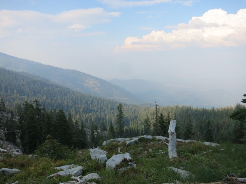
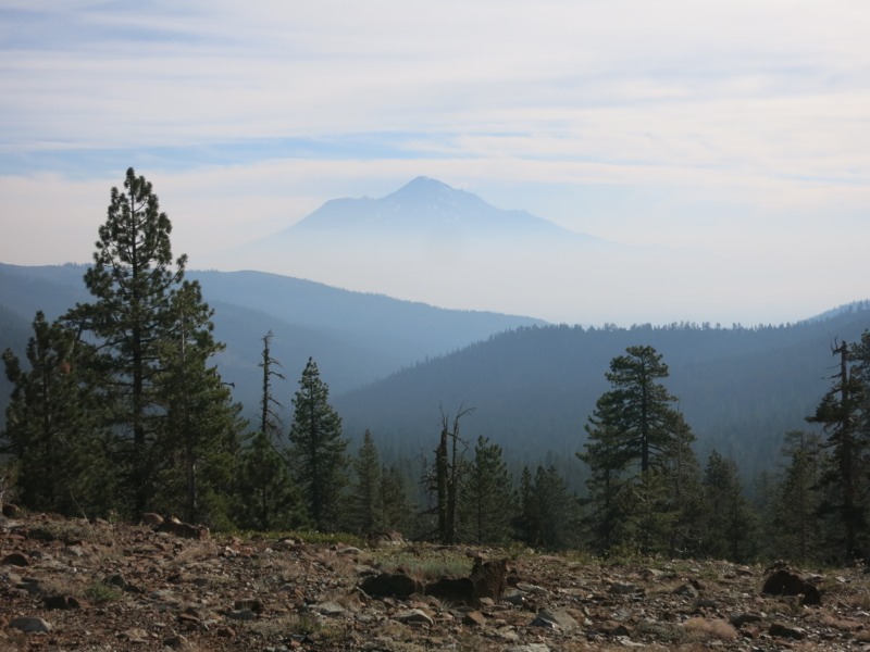
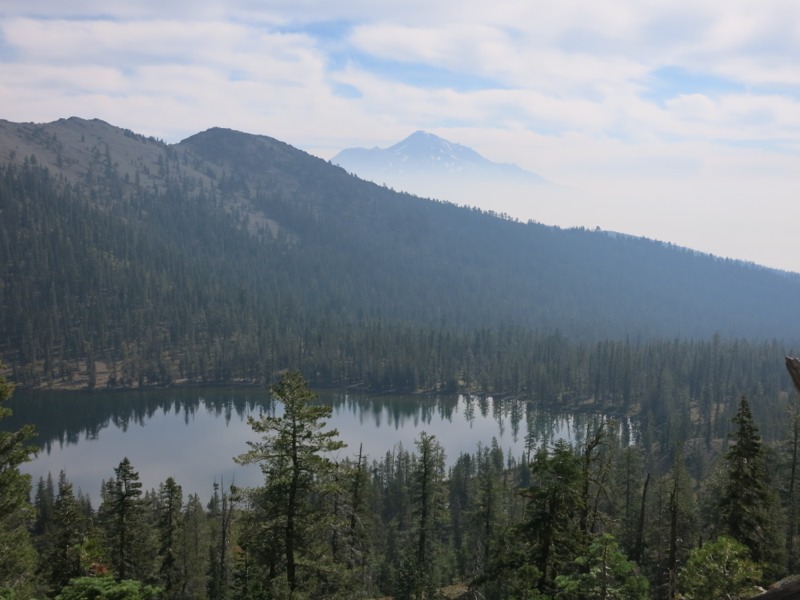
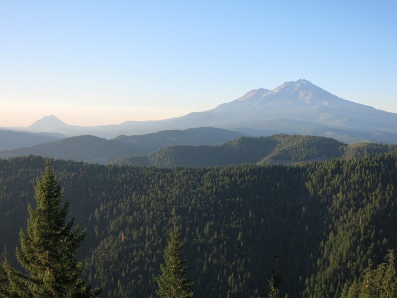
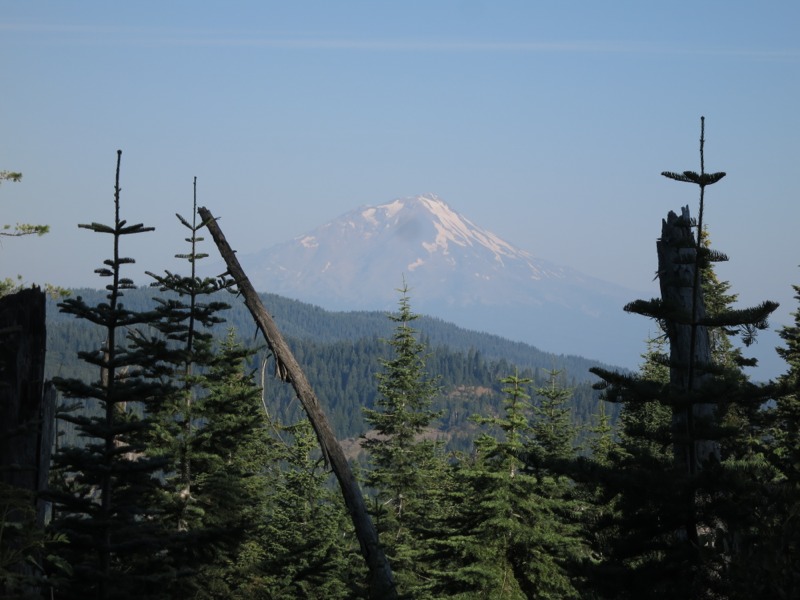
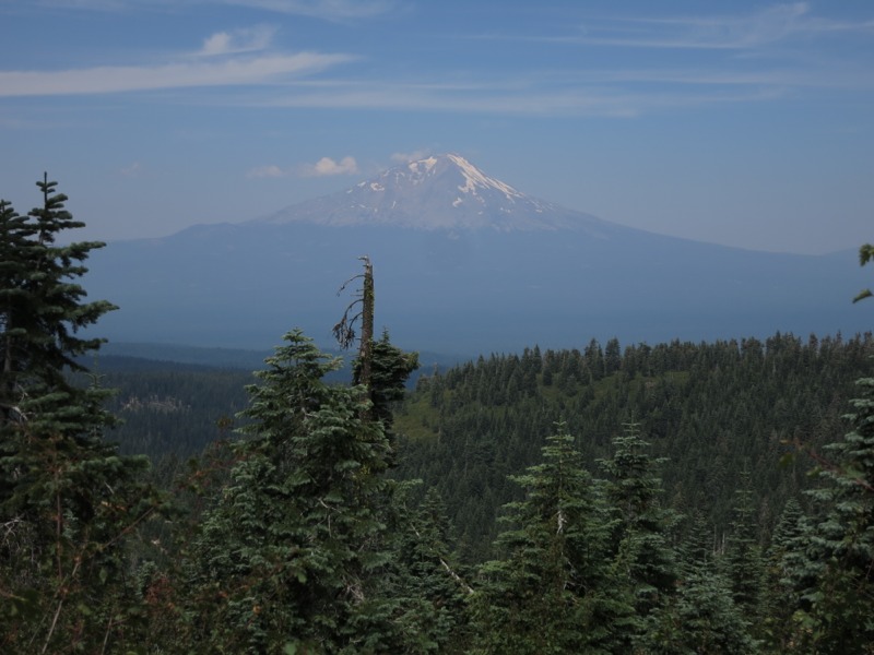
Last night was the coldest we’ve had in a while, with a nice stiff breeze blowing through our ridgetop spot. It made for very comfortable sleeping and a cool morning. In the morning we were surprised to see Mt. Shasta perched on the horizon in front of us. We hadn’t been able to see it last night through the haze so it was as if it had appeared overnight. It’s gotten a lot bigger since the last time we glimpsed it while coming down off the Hat Creek Rim. It’s exciting to see the progress we’ve made in just a few days.


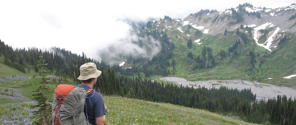
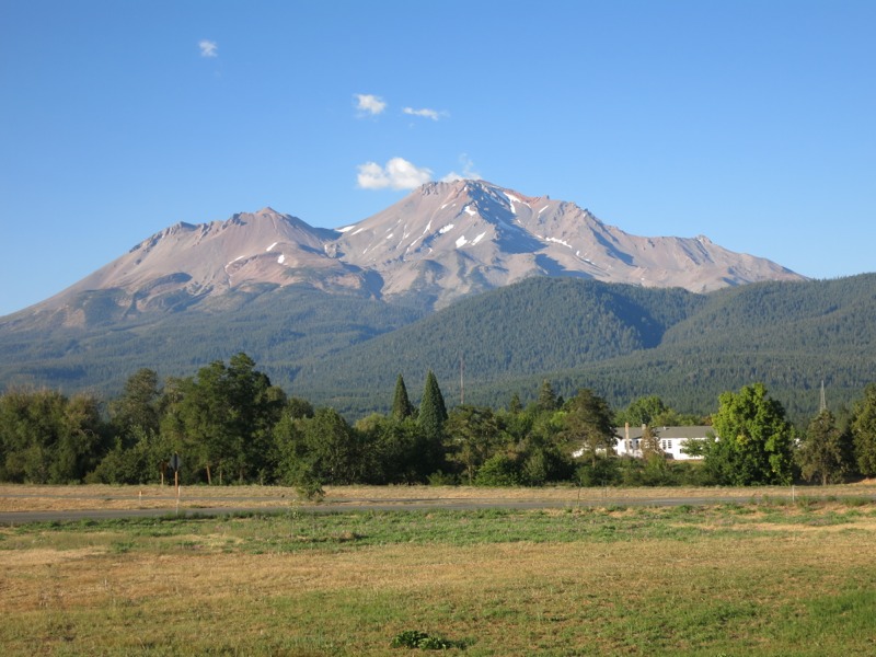
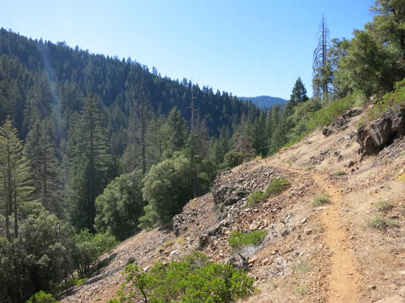
We continued west over trail that was alternately good and rough. The breeze held on for the most part so it was a little cooler than we were used to – a welcome change. At one point we reached a long, exposed ridge that gave us a clear view of Shasta and its foothills, while we’d previously only seen the peak. It was breathtakingly massive, dominating the entire horizon with nothing between us and it but open space. We could see where the trees ended and the snow-streaked rock cone of the summit began. If we lived nearby, would we ever get used to seeing it hanging over us?


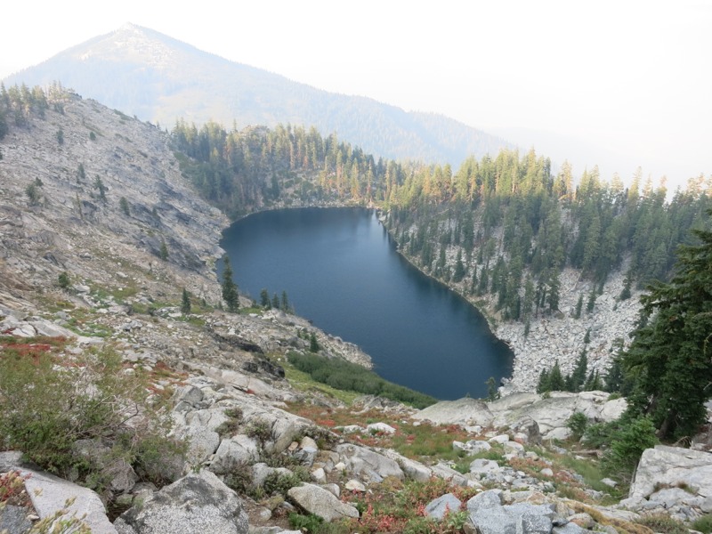
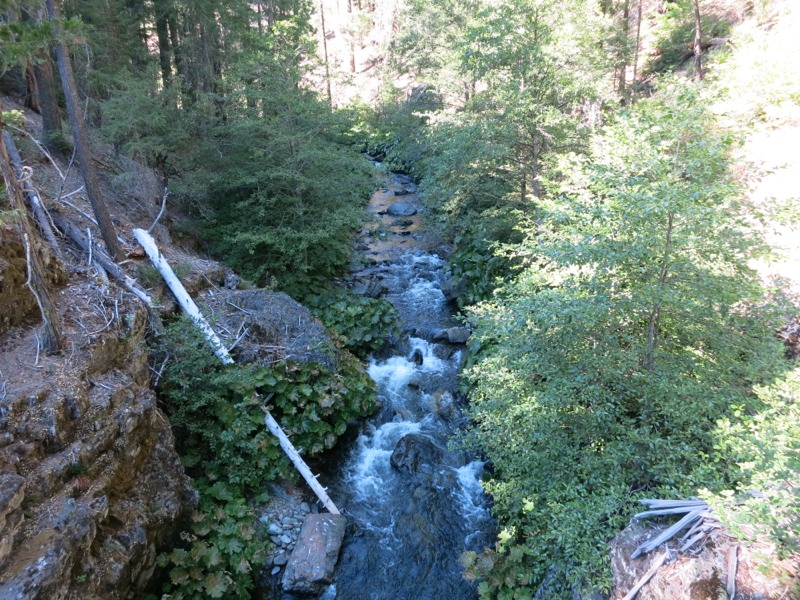
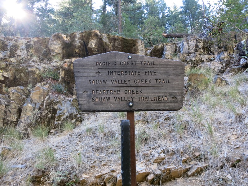
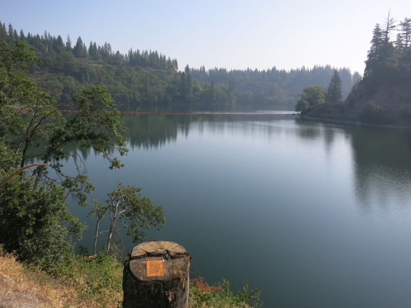
For lunch we took a bit of a gamble. A side trail leading to a creek was listed in our guidebooks as unmaintained and nearly impassable. Unfortunately, this creek was the last water for about 8 miles. Instead of taking the spur trail we decided to hike along a forest road that would place us near the water. This can be a dicey prospect because the roads aren’t always maintained and can sometimes peter out into nothing. In this case it worked out perfectly. We didn’t even have to backtrack to get to the trail because the original spur trail was in much better condition than the guides had said.


We were sort of expecting this, actually. For the last few hundred miles the water sources have been extremely well signed and maintained. We’ve come across more than one spur for an off-trail spring that wasn’t on our maps. The forest service has done a fantastic job on this and it’s so important to hikers.

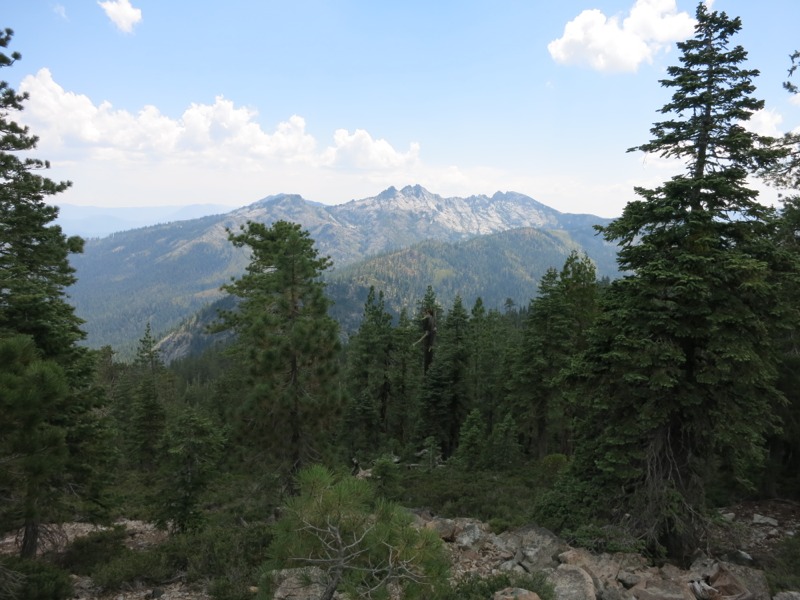
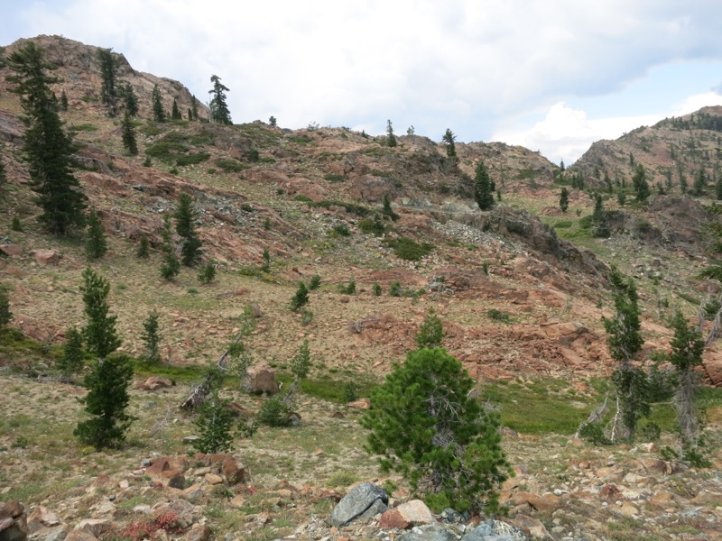
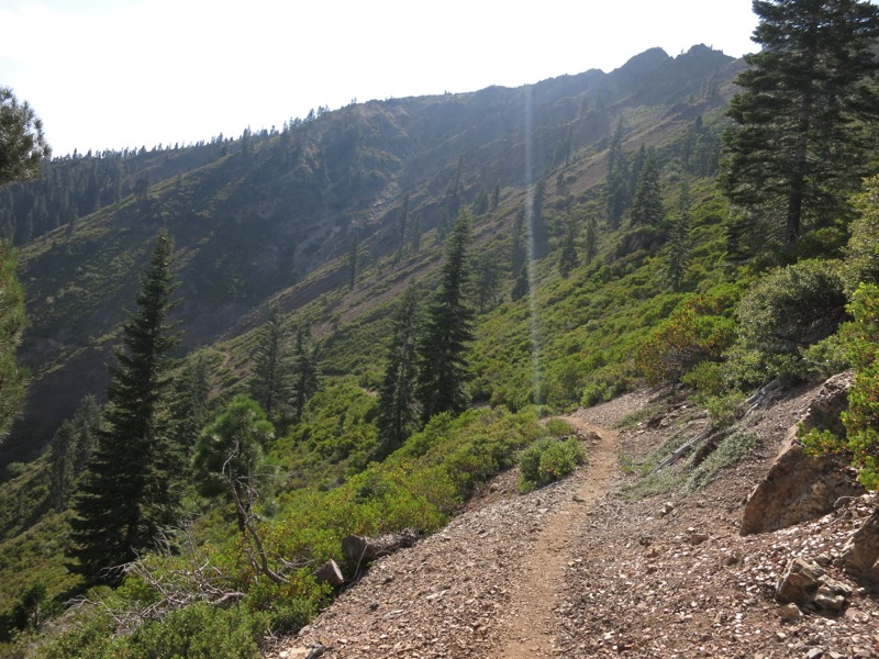
After lunch we returned to the trail and set off west. We skirted the slopes of Grizzly Peak, a fixture on the horizon over the last few days. The sun beat down on us as we climbed through dry manzanita scrub. We were shooting for the lofty goal of a campground 29 miles out from where we stayed last night. Including the off-trail mile for water this would mean that we’d hiked 30 miles today – a big PCT milestone. Doing the math, we started to realize that we had a shot of making it. I tried not to think about it, like a pitcher working a no-hitter.

We made good time to the creek 8 miles from lunch and then to another 5 miles from that. This was our decision point – did we head for the campground or did we get water here and find a campsite on one of the few upcoming flat stretches? We wouldn’t get many other chances since we were hiking on the sides of steep canyons. We decided to go for it. The last few miles were the toughest we’ve done in a while. Our feet were sore and we were soaked in sweat – no cool breezes down here, off the ridges. I had been working on a matching set of heel blisters ever since our rim hike, and although they felt better this morning today had definitely been a setback in that department. They were especially unhappy now. Finally we started down the last switchbacks, trying to avoid all the poison oak. Just then Keith stumbled…and broke his hiking pole. It had already been bent and was bound to snap sometime, but that it should happen now was almost comical. At least we’ll be in town the day after tomorrow. It’ll make the remaining miles a lot tougher, though.

When we reached the trailhead (Centipede Gulch – sounds inviting) we were greeted by a crowd of people. We’d forgotten that it was Saturday night. We’d arrived at a good time, though, because they had a plate of sausages right off the grill and they insisted we take some. They were delicious and just what we needed after reaching our goal. From there we headed down to the campground near the McCloud river and set up. Keith scored us a couple of cold sodas from some nearby campers to celebrate our accomplishment. They happened to be ginger ale, the champagne of sodas, which was both fitting AND delicious. Crawling into our bags was pure heaven…but we’ll see how we feel tomorrow.

– Posted from the PCT

Location:Pct mile 1476

Day 106 – Burney Falls to ridge camp – 23 miles


Today was a fairly uneventful hike. It was hard to get up for some reason – our bags were especially comfortable in the cool morning. Finally we got ourselves in gear and headed out. We passed the Pit Dam at the end of Lake Britton and walked across the top of its spillway. A diversion tube to one side was spewing out a massive volume of water.


After crossing over we climbed steeply for a bit before leveling out. After a few miles we reached Rock Creek, where we cooled off and did our laundry. The creek had an awesome swimming hole, but it looked like a death trap to get down to it. The water was too cold for our tastes anyhow. This marked the start of an 8 mile climb that took us up through the forest over occasionally overgrown trail. Hikers joke that section O (which we started at Burney Falls) stands for overgrown, since this part sees less trail maintenance than others.


We fought through the brush and dodged poison oak until we reached Peavine Creek and had lunch with a few other hikers. The rest of the day went in a similar vein, but with less climbing. The trail condition got worse – more overgrown and rocky (a tough combination) and washed out in places so that a big channel full of stones ran down the center of it. Combined with the heat and a few open burned sections it made for a rough hike. We stopped after a few miles to load up with water and then continued on until dark before we made camp. This stretch isn’t as dry as the rim we came over, but it does have limited water sources. We camped up on a rise with a lovely view of the fading sunset. They have been especially colorful lately, probably due to fires and the haze in the air.


– Posted from the PCT

Location:Pct mile 1447