Day 99 – Belden to Cold Spring – 18 miles


It was so hot last night that it was hard to get to sleep. We were grateful to be sleeping in a real bed, though. We woke up to an actual rooster crowing and caught an early ride back to the trailhead. From there we walked back to the restaurant at the resort to get a hearty breakfast. The food was really well-cooked and the portions were huge, so we had some leftovers to carry with us for lunch. As we got ready to leave it was already getting hot and we soaked ourselves with water in preparation for the climb ahead of us.


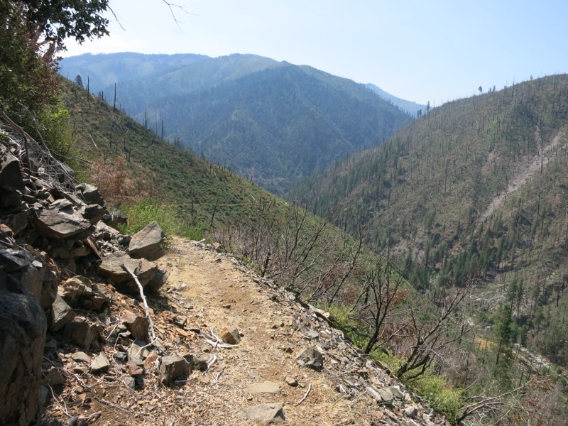
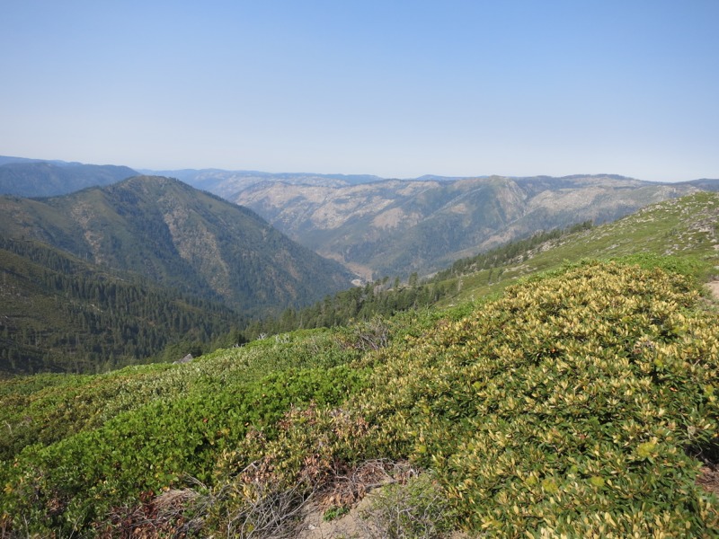
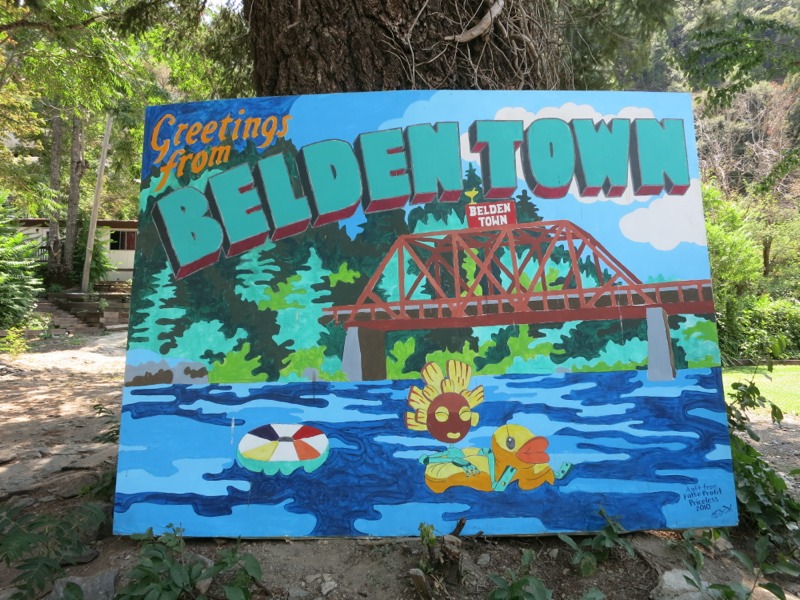
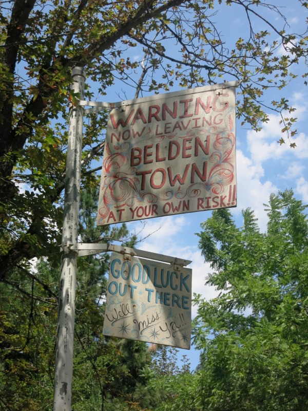
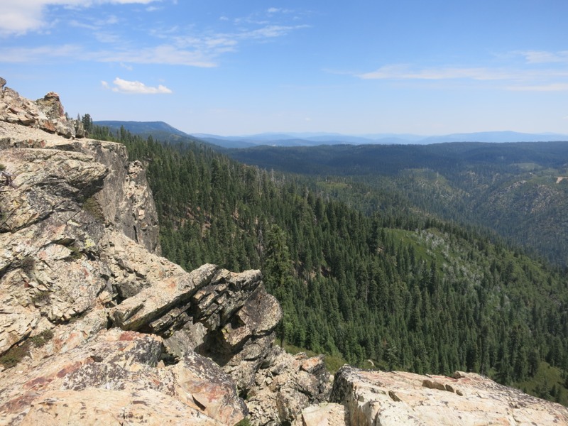
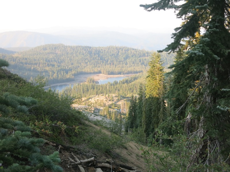
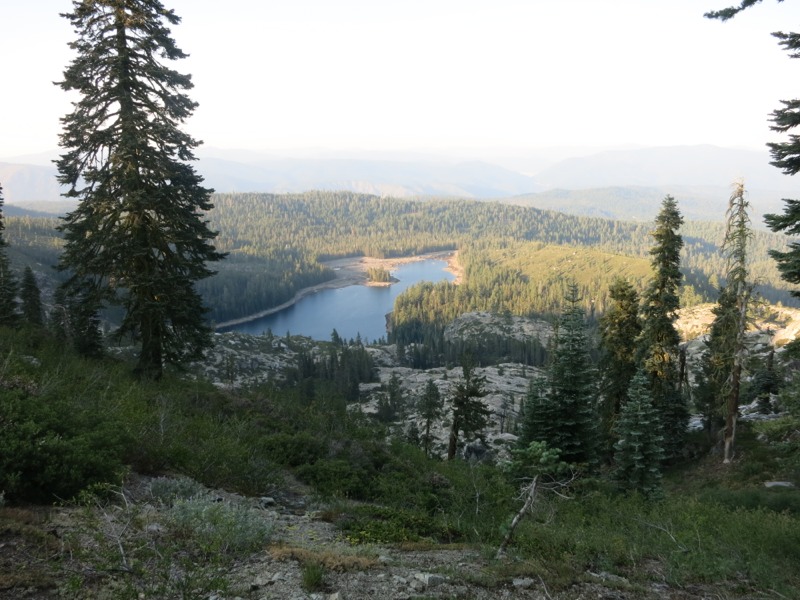
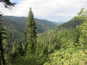
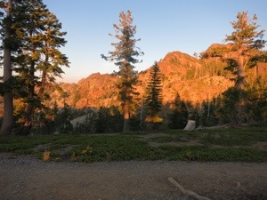
For every big downhill there’s usually a big uphill as you climb out of the canyon you dropped into. Belden was no exception and we faced almost 5000 feet of gain over 14 miles. It would be a test of our endurance. We started out in partial shade but were still sweating in the building heat of the day. We climbed parallel to the highway for a few miles before turning north and heading up the Chips Creek canyon. We hiked through a gauntlet of poison oak lining both sides of the trail. Before long our meager shade vanished completely as we entered the scorched area from the Chips burn last summer, caused by a hiker’s improperly put-out fire.


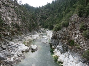
This section would have been much tougher if not for the creeks and springs that crossed the trail every mile or so. We were able to stop almost whenever we needed and cool down with wet bandannas. We took our time and drank so much water that we had to stop and filter more. With this relaxed pace we reached the end of the burn still feeling strong. How much easier would Southern California have been if we’d had ice-cold water available every few miles?


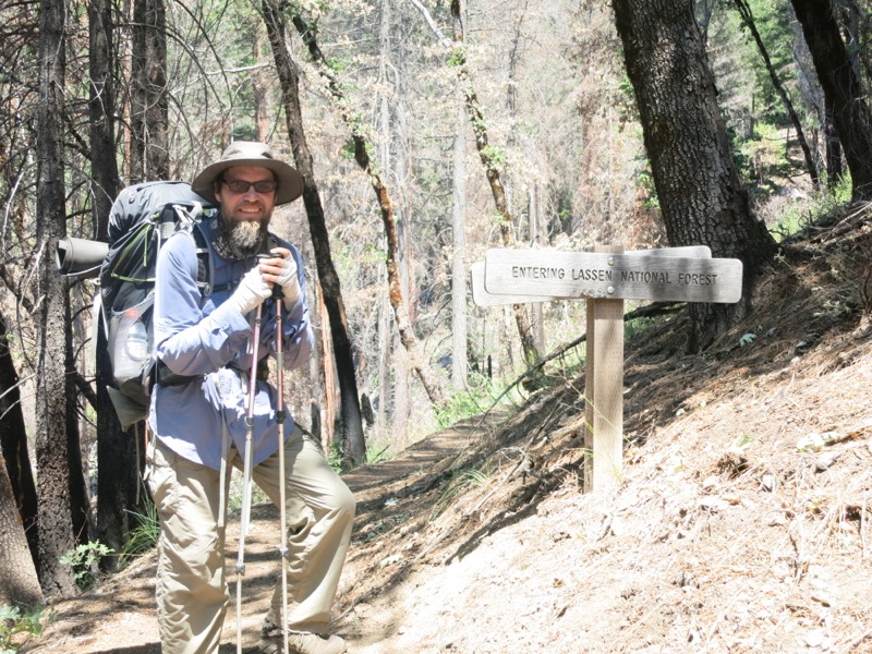
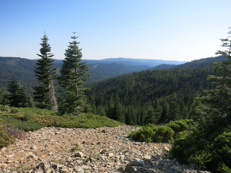
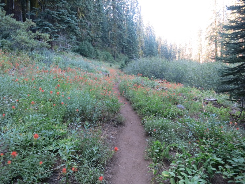
This brought us out of Plumas and into Lassen National Forests. We kept climbing, pushing through undergrowth that was blocking the trail. Chips Creek continued to rush through the canyon below us, a constant back note to our huffing and puffing. Finally we crossed it twice in quick succession and stopped for lunch at the second crossing. Leftover breakfast potatoes and the remainder of an enormous piece of ham (originally as big as my face) hit the spot in a very satisfying way. The wasps thought so too, and as soon as the food appeared we had visitors checking us out. Defending our food didn’t make for a very relaxing lunch but it did make us move faster than we would have otherwise.


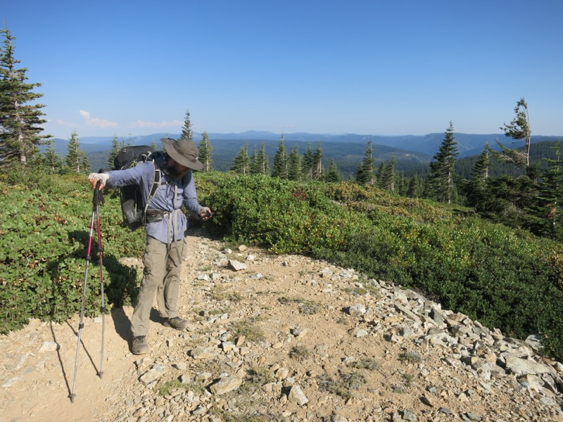
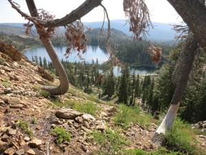
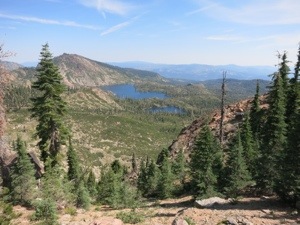
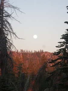
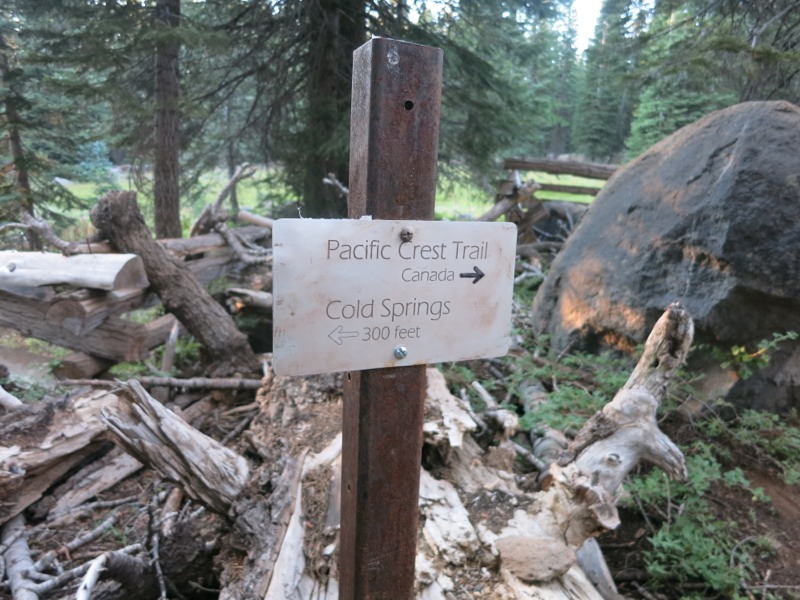
After eating it was back to the climb for another few miles. A little more hiking brought us out of the trees and into a meadow, then over soft dirt trail to the open top of the ridge at last. Here we met Busted, a hiker new to us, and we chatted as we cruised the last 5 mostly-downhill miles to Cold Springs and the end of our day. When we arrived we found the place crowded – everyone from the Braaten’s the previous night was there along with Fireball, a hiker we’d been leapfrogging ever since we left Sierra City. We had no trouble finding a spot off on our own and mostly out of earshot. The spring water was cold as promised and was piped into a metal trough, making it easy to fill our water bottles. The air was finally cooling off and we looked forward to a comfortable night.


Tomorrow we will reach the halfway point of the trail after over three months of hiking. It feels strange to think about – long overdue and too soon at the same time. We’ve been out here working hard every day but it still feels kind of sudden. It makes me think back to the very beginning, when 100 miles seemed impossibly long and we counted off every tiny fraction of distance as we passed the milestones – one tenth, one fifth, a quarter. Some hikers are starting to get homesick. We think about home and family a lot and are looking forward to seeing everyone, but I’m happy to find that we’re in no hurry whatsoever to finish and go back earlier than we have to. It’ll all be there when we get back and we’ll be back soon enough, with this incredible 6 months in the past.

– Posted from the PCT

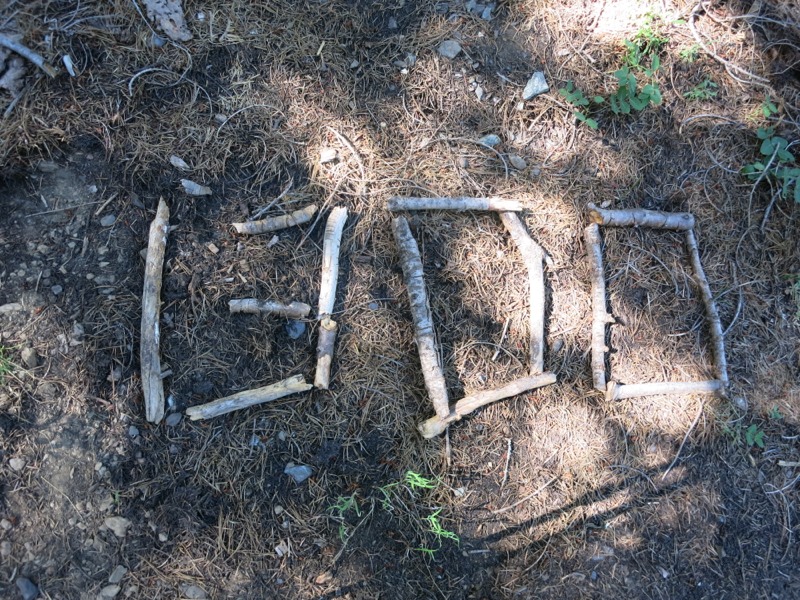
Location:Pct mile 1309

Day 98 – Clear Creek Spring to Belden – 13 miles


The first part of our hike this morning took us through the forest and to the bald ridge tops outside the town of Belden. We caught our first glimpse of Mt. Lassen in a few days – it’s not a very tall peak and previously it seemed that there were always trees or other ridges in the way. It disappeared quickly as we started our decent into Belden – a long 5000 foot drop over innumerable switchbacks. We had to be on the lookout for poison oak, as we will for much of the rest of California.


The descent was easy but a bit monotonous. Gnats liked to swarm around our faces but luckily they didn’t seem to bite. Near the bottom we passed a trail crew on their way up. We made sure to thank them for their efforts! At the bottom we hiked right into the Belden Town Resort, apparently the site of weekly raves that we’ve heard a lot about. Our guidebook describes this place as creepy, but I didn’t really get that vibe. Eclectic, maybe, but not creepy.


We were planning to stay with the Braatens, local trail angels that lived just up the highway. They came to pick us up since they hate to have hikers walk the narrow, dangerous road. They have an entire mini-unit for the hikers to use including two bedrooms, a bathroom and kitchen. It was very hot in the river valley and our cool showers felt wonderful after the last few sweaty days. Afterwards we walked up to the little country store/RV park nearby to do our laundry, buy snacks and get milkshakes. It was a nice, relaxing afternoon. Towards evening a few other hikers arrived and we chatted with them for a while before turning in. We’ll head out tomorrow morning for Chester two days away, but we were very grateful for our mini-day off.


– Posted from the PCT

Location:Pct mile 1278

Day 97 – ridge camp to Clear Creek Spring – 22 miles


Sometime very early this morning we woke up to sprinkles. We hopped out of the net tent to put the rain tarp over everything and cinched it down. The rain stopped a few minutes later and the moon came out…but we’ll take that over having to pack up wet gear. It took a long time to get back to sleep.


The next morning we started right off with the rest of the long climb. Mile after mile, winding around the ridges, we worked our way up. It was hot already and we were sweating freely. I had a goatee of droplets running off my chin. After a few miles we arrived at a little trickle of a spring, where we wiped ourselves off in preparation for adding a new layer of salt during the rest of the climb.


Finally we reached the exposed ridge that marked the end of the steepest part. From there we meandered up and down, stopping for a break and a snack in a patch of shade. Some rock ledges gave us a semi-panoramic view of the surrounding terrain – rolling ridges as far as the eye could see, carpeted in lush coniferous forest. We headed north, thinking about cold drinks and burger lunches. We passed a sign from some local trail angels inviting hikers to their cabin – a very tempting prospect, but we had a goal in mind already.


After 5 miles of easy terrain we reached the road leading to Bucks Lake and the resorts there. It was a long, hot walk but there was very little traffic on the road so we didn’t have to worry too much about walking on the sometimes-narrow shoulder. As we turned a corner on the last leg, a man stopped in his car and told us to come up to the campground and share his site if we happened to stay the night here. We knew we would be tempted when we were full of food in the heat of the afternoon, but the town of Belden is reachable by lunch tomorrow if we put in a few more miles.


Soon after that we reached the store and picked up some cold drinks to have on the way to the resort another mile up the road. The woman at the counter guessed (somehow) that we were hiking the PCT and this got the attention of a family who had dropped by to pick up some snacks. They were impressed to hear that we had come all the way from Mexico. After a little more chatting, they offered us a ride to the restaurant – which we gratefully accepted! Fred and Erin and their girls were camping at one of the nearby campgrounds. We jumped in the back of their truck and were there before we knew it, sitting on the patio under a big shady umbrella and looking out over the lake as we sipped our sodas. It was absolute heaven after all the sweating we’d done over the past few days.


They had lunch at the table next to us and when we finished we discovered that they had picked up our tab for us – how generous is that, to pay for a couple of stinky hikers’ lunches! More than that, they offered us a spot down at their campsite with the promise of “tons of food.” A hiker’s worst dilemma – food or town (and the promise of showers and laundry)? In the end, with Belden so close, we had to decline but we were extremely close to ditching the rest of the day in favor of more calories and conversation. Then came the icing on the cake – they offered us a ride back to the trail, saving us a few more miles of scorching road walk on full bellies. Guys, if you’re reading this, I hope you know that you made our day absolutely wonderful! It was awesome to meet you all and thank you again for all your generosity!


At the Bucks Lake trailhead we reluctantly said our goodbyes and started up the hill, because of course it started with a climb. It was nothing compared to this morning but soon the inevitable sweat-drenching began all the same. We stopped at a creek a mile up to filter some water, then continued on our way. As the grade eased we found ourselves in a meadow filled with scarlet paintbrush. Hummingbirds were zooming around everywhere, fighting over patches of flowers and scolding and chasing each other. It took us a while on this hike to stop being startled by the sound of them flying nearby because they sound like the world’s biggest, ugliest bug. They’ve been around consistently since Southern California and through the Sierra.


We sweated up the ridge to the summit of Mount Pleasant. To our east were Silver and Gold Lakes, down off the cliff nestled into a sheet of granite. They were beautiful but looked much lower than normal with wide patches of dry lakebed showing. After crossing a few more minor ridges in the forest we passed Clear Creek Springs, our water source for the night, and an occupied stretch of flat ground. We went one more ridge over and found a flat spot down off the trail to spend the night. Tomorrow we have 11 miles to hike to Belden. It’s mostly downhill – we’ll lose nearly 4500 feet as we switchback down into the canyon for the north fork of the Feather River. Our reward for getting past all the poison oak will be showers, clean laundry, and milkshakes up at the store. We can’t wait to wash off all the sweat from the last four days.

– Posted from the PCT

Location:Pct mile 1278

Day 96 – Whiskey Spring to ridge camp – 24 miles

We were awakened by some early morning visitors today – deer crashing around near our tent before the sun came up. When we shined our lights on them they just stood there and looked at us dumbly. Maybe they couldn’t tell what was going on with the net tent, but it took some scolding to get them to leave so we could go back to sleep.

Other than that it was a pretty uneventful morning. Our tent was in the shade but we could still feel the heat and humidity as we packed up. We started out on a slight climb through open forest and hilltop meadow, then spent the rest of the morning on gentle hills in the woods. We crossed a lot of roads – a few real ones, even, with pavement and lines and everything. There’s logging activity in this area and we saw a few trucks loaded with timber. On one lookout I think we caught our first glimpse of Mt. Lassen, still a few days away.
20130807-160203.jpg

We stopped at a creek for lunch, hoping that it would still be running since it was a steep hike down. It was and the icy water helped revive us. After lunch we started a long, switchback-filled descent down to a fork of the Feather River. We’d been looking forward to this all day – there was supposed to be great spots for swimming down in the canyon. As we dropped down, avoiding the poison oak, the skies clouded over and a breeze came up. By the time we reached the steel arch bridge high over the river, it had cooled off significantly and looked as though it might rain.

We dropped our packs at a well-used campsite and walked out to the river, where we sat and soaked for a little while. It felt great to clean the dirt and sweat off our legs and faces. The water was warm enough to swim in, but neither of us wanted to take the time since we had a long climb out of the canyon waiting for us. Instead we just sat and watched the dipper birds hopping around on the rocks next to the churning water. They stuck their heads into the bubbling pools to look for bugs and other tidbits. This river will definitely go on our list of places to revisit someday when hiking isn’t our main goal.
20130807-160133.jpg

After our relaxing soak, we began the climb out of the canyon – the flip side of the long downhill into it. It was steep but we made surprisingly good time. This is the payoff for spending weeks above 8000 feet. When we drop down to 3000 feet the air is so much richer that we were barely breathing hard. We certainly were sweating, though. The nice breeze that had cooled us off at the river was gone and it was incredibly muggy. We had three water sources coming up. We planned to get water at the third before hiking up another mile or so to a spot on the map that looked like it might be flat enough to camp on. This was a bit of a gamble since there was no campsite marked on our map. It if wasn’t suitable we’d probably have to push on another few miles until we reached the top of the climb.

We passed the first two water sources in quick succession and crossed our fingers that the third (a small creek) was still flowing. It was, with great force, and we stood in front of its cascade and caught the cold damp air rolling off it. It was like having our own air conditioning. We loaded up with water, carefully crossed the mossy, slippery rocks, and hiked on. By now it was starting to get dark and we were anxious to find out if our gamble would pay off. We trudged up and up and rounded a corner, and there it was – a flat campsite big enough for three tents, complete with a fire ring. This was better than we had dared to hope for. The bugs started in on us right away so we got the tent up in record time and dived in. Tomorrow we face the last 5 miles of this steep climb, but we’ll reach a restaurant by lunch and be able to get some real food. The day after that we should reach the town of Belden for another short break. We’ve been making great time on this section so far.

– Posted from the PCT

Location:Pct mile 1256

Day 95 – Packer Lake Saddle to Whiskey Spring – 24 miles

The sun woke us up this morning by painting us with heat. It had streamed the sky over the buttes with orange and scarlet. We packed up and moved up the trail into the forest to have breakfast in the shade, where it was still almost cool enough to wear a jacket.
20130807-154815.jpg

The morning consisted of another ridgewalk – a mix of slight grades, rocks, and nice smooth trail. We made great time as we skirted rocky spires and patches of dark shady pine forest. We crossed from the Tahoe into the Plumas national forests and passed overlooks high above a series of large lakes. We could see cars parked down at the boat launches and people out cruising around, leaving wake marks that followed them across the length of the lake. Towards lunch time we arrived at an intersection of dirt roads and the A-tree spring, gushing with cold water. It was super refreshing after the last few hot, exposed miles.
20130807-154906.jpg

Our afternoon was much tougher and less scenic than the morning. It started with a moderate climb – not too steep and partly shaded, and we had wet ourselves down at the spring. Near the top we could see one last view of the buttes we’d climbed to yesterday from town, now hazy and indistinct in the distance. Once we got to the top of the ridge we started right down the other side and continued for a few miles through more pines. Then we started up again – and up, and up, over the course of a few miles. The trail we were on now was poorly maintained. We frequently had to get over blown down trees, which is a challenge when they come up to mid-thigh and you’re wearing a heavy pack. At times the sandy trail tread was wearing away and we had to be careful where we put our feet. Some sections were steeper than we’re used to seeing on a trail graded for stock animals. The saving grace was that the sky had hazed over, blunting the heat of the sun. We were still sweating freely but it was much better than if the sun had been as strong as it was around lunch.

Finally we reached the top with a few more miles to go before camp. The last stretch was along the top of Bunker Hill Ridge – open and breezy with the views we’d been missing of the surrounding peaks and valleys. The trail leveled out along the ridge and we were glad for it. We hiked for a mile or so before catching sight of our next water source way down below. It was a small pond – our least favorite source to draw from, but we weren’t sure if a spring another mile up was flowing, so we had decided to fill up here and dump it later if we found better prospects. Past the lake there was a rough, steep side trail plunging down to access the water. We dropped our packs and then dropped down ourselves to reach what our map named Duck Soup Pond – although it looked more like Duck something-else Pond. There were a few other hikers camping down on the pleasant open shore next to the water. We filled up and started back up the eroding trail, hopeful that we wouldn’t actually have to use it.

We didn’t, as it turned out. Less than a half mile later we came across a sign for Whiskey Spring a few tenths of a mile down off-trail. This wasn’t in any of our guides or maps, but the water sources over the last few days have all been well-signed in this manner. Maybe this is a recent thing. We dropped our packs again and went to investigate.

We found the spring running clear and well, much better than the pond water we’d collected. We headed back up to our gear. While Keith went back down to fill up I wrote a note about the spring for the hikers behind us, then hiked back to post it at the top of the pond trail. It’s nice to be able to pay forward some of the trail karma we’ve benefited from. When I got back I set up camp and finished just as Keith returned up the trail. It’s already cooler than it was last night and a nice breeze is hissing through the pines. I love camping out on our own, with no one to bother and no one to bother us.

Location:Pct mile 1231

Day 94 – Sierra City to Packer Lake Saddle – 10 miles

We slept in the most comfortable bed ever last night. After rib dinner, incredibly crisp watermelon and a pint of Ben and Jerry’s we dragged ourselves onto the cushy memory foam mattress and passed out for 11 hours. The droning of a fan provided white noise and blocked out voices from the yard. It was the best night’s sleep I’ve had since starting the trail.

This morning we slept in – it was impossible not to – and then stepped into the bar for breakfast. Delicious home cooking and Margaret even made us an extra stack of pancakes to carry back to the trail with us. This afternoon or tomorrow morning they will be a treat. After stuffing ourselves we went back to the room to clean up and pack. By then it was already stiflingly hot and we rewarded our efforts with drinks and Popsicles from the store. I had some journaling to catch up on now that we had a good wifi connection so we sat out on our deck in the shade and passed the time. One hour turned into a few hours. We were sweating while just sitting there, cool drinks in hand, and this made it hard to think seriously about hiking up the road to the trail. That and the nearly 3000-foot climb to the buttes awaiting us.

We whiled away a few more hours as the peak of the 100-degree afternoon heat passed. Bob, the other owner of the inn, said that this weather is more typical of late August than July. At nearly 4 pm, after another round of cold drinks and Popsicles, we finally started up the road. Keith caught us a hitch to the trailhead that saved us a mile of road walking. Then, with full packs and lots of water, we started up the many switchbacks to the butte. The climb was almost relaxing. We were thoroughly rested, well shaded from the sun and happy to be heading away from the road noise.

After a few miles of steady climbing we broke above the treeline just east of the buttes, huge jagged towers of rock that still loomed 2000 feet over us. We skirted them, climbing slightly on rocky, exposed trail. Sometimes we’d pop into a canyon beyond the late sun’s reach and it was as though someone had switched off a heat lamp. At last we crossed a jeep road and entered a blissfully dark and cool forest. A little more climbing brought us to the end of the long ascent and the grade eased, leading us gently up and down through rocky, semi-open woods. We caught glimpses of the spines of rock from across a deep valley. They were painted pink by the setting sun.
20130807-154137.jpg

We crossed a few forest roads and had to consult our GPSs to find out where the trail led. Usually it’s much better signed than this. Eventually we found our way to a ridge high above Packer Lake and spotted a campsite a short way below the trail. We jumped on it and hoped there were few enough bugs to cowboy camp. The moon is incredibly bright tonight – we don’t even need our headlamps.
20130807-154217.jpg

– Posted from the PCT

Location:Pct mile 1207